
IMAGES TAKEN NEAR TO
Slades Farm Road, BOURNEMOUTH, BH10 4ES
Introduction
This page details the photographs taken nearby to Slades Farm Road, BH10 4ES by members of the Geograph project.
The Geograph project started in 2005 with the aim of publishing, organising and preserving representative images for every square kilometre of Great Britain, Ireland and the Isle of Man.

There are currently over 7.5m images from over14,400 individuals and you can help contribute to the project by visiting https://www.geograph.org.uk
Image Map
Images are licensed for reuse under creativecommons.org/licenses/by-sa/2.0
Notes
- Clicking on the map will re-center to the selected point.
- The higher the marker number, the further away the image location is from the centre of the postcode.
Image Listing (168 Images Found)
Images are licensed for reuse under creativecommons.org/licenses/by-sa/2.0
Image
Details
Distance
1
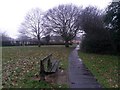
Ensbury Park: a bench on footpath N26
Looking along the linear public open space within the Slades Farm housing estate. The paved path is a rerouted version of the original Slades Lane and is designated as public footpath N26, the main path through the space.
Just behind us, the path has split to form a triangle here, with access to Slades Farm Road ahead and another path heading to Cornish Gardens, off to the left. Alongside the hedge in the background, another path runs between the two to complete the triangle.
See Image for the view behind us, and Image for the view out onto Slades Farm Road ahead - each with links to further photos on the mentioned routes.
Image: © Chris Downer
Taken: 14 Feb 2017
0.02 miles
2
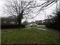
Ensbury Park: footpaths N26 and N29 reach Slades Farm Road
The two public footpaths here form a triangle along with path N30.
Path N29, to our left just takes us the short distance back to Cornish Gardens, while the longer N26, on the right, takes us through an open space between the backs of houses, towards Columbia Road.
See Image for the next picture of path N26, with further links to photos all along the path and connecting ones.
See Image for the view towards us from the pavement ahead, and Image for the next picture on path N29, left.
Image: © Chris Downer
Taken: 14 Feb 2017
0.02 miles
3
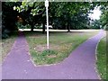
Ensbury Park: footpaths N26 and N29 from Slades Farm Road
The two public footpaths here form a triangle along with path N30 (see Image]).
Path N29, to our right, just takes us the short distance to Cornish Gardens, while the longer N26, on the left, takes us through an open space between the backs of houses, towards Columbia Road.
See Image for the view onto the road from on the grass ahead, and Image for the next picture of path N26 as it heads north, with links to further photos along the route.
This was once part of the historical Slades Lane route to Talbot Village, which is still available albeit with a little interruption from here. It starts a short distance behind us in Ensbury Avenue - see Image
Image: © Chris Downer
Taken: 15 Jun 2016
0.02 miles
4
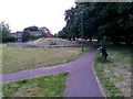
Ensbury Park: footpath N30 joins footpath N26
Having come along public footpath N26 from its southern end, it reaches this point via the left-hand path in the foreground and heads towards Archdale Close and Columbia Road by way of this open space, between the backs of houses on the various roads of the estate. Ahead of us is a small enclosed children's play park.
See:
Image for the next picture on path N26 path, ahead;
Image for the next view on path N26, behind-left; and
Image for the next view on path N30, behind-right.
Each has links to further photos along the routes.
Image: © Chris Downer
Taken: 15 Jun 2016
0.02 miles
5

Ensbury Park: footpath N30 swings northward
Looking along public footpath N30, which forms the eastern side of a triangle of footpaths, with N29 visible at the bottom of the picture, and the start of path N26 over to the far left. Footpath N30 converges with path N26 just past the tree, whereupon the latter path continues through the open space towards Columbia Road.
See Image] for the view of paths N29 and N30 diverging, just to our right, and Image] for the convergence of paths N30 and N26 in the distance.
Image: © Chris Downer
Taken: 9 Jul 2016
0.03 miles
6
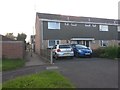
Ensbury Park: footpath N21 to Singleton Drive
The less substantial of two public footpaths, a few doors apart, running through from Slades Farm Road to Singleton Drive. The path crosses a rear access driveway halfway along.
See Image for the view this way from the driveway, and Image for the other, wider path.
Image: © Chris Downer
Taken: 3 Jul 2016
0.03 miles
7
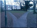
Ensbury Park: footpaths N26 and N31 diverge
Looking south along the public open space within the Slades Farm open space. The main path through the space, footpath N26, comes from Archdale Road behind us and continues ahead-right towards Slades Farm Road.
To the left, footpath N31 is a short spur linking Cornish Gardens.
See:
Image for the view along the path behind us from just ahead;
Image for the next view on path N26 ahead, from the next path junction just visible; and
Image for the view around to our left on path N31.
Each has links to further photos on all the mentioned routes.
Image: © Chris Downer
Taken: 13 Feb 2017
0.03 miles
8
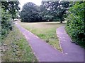
Ensbury Park: footpaths N29 and N30 diverge
Having walked a little way along Image], we have a choice of continuing (left) on that path, or heading right onto footpath N30 (Image'>Image). N30 is a short path, linking path N26, which is all but visible in the background as the third side of the triangle - N26 then continues northward through a pleasant open space towards Columbia Road (Image).
Image: © Chris Downer
Taken: 15 Jun 2016
0.04 miles
9
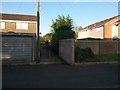
Ensbury Park: eastern half of footpath N21
This public footpath from Slades Farm Road to Singleton Drive crosses the rear garage driveway halfway along. This is the view towards Slades Farm Road from the driveway.
See Image for the view towards us along the path ahead, and Image for the similar view along the other half of the path, behind us.
Image: © Chris Downer
Taken: 3 Jul 2016
0.04 miles
10
Ensbury Park: footpath N31 swings round to Cornish Gardens
One of a network of public footpaths on the Slades Farm open space within the housing estate. See Image for the view towards us from the path ahead.
Just behind us, the path converges with the main footpath through the open space, path N26, as can be seen in more perspective here: Image This linked photo contains further links to photos along path N26.
Image: © Chris Downer
Taken: 13 Feb 2017
0.04 miles