IMAGES TAKEN NEAR TO
Hibberd Way, BOURNEMOUTH, BH10 4EL
Introduction
This page details the photographs taken nearby to Hibberd Way, BH10 4EL by members of the Geograph project.
The Geograph project started in 2005 with the aim of publishing, organising and preserving representative images for every square kilometre of Great Britain, Ireland and the Isle of Man.

There are currently over 7.5m images from over14,400 individuals and you can help contribute to the project by visiting https://www.geograph.org.uk
Image Map
Images are licensed for reuse under creativecommons.org/licenses/by-sa/2.0
Notes
- Clicking on the map will re-center to the selected point.
- The higher the marker number, the further away the image location is from the centre of the postcode.
Image Listing (190 Images Found)
Images are licensed for reuse under creativecommons.org/licenses/by-sa/2.0
Image
Details
Distance
1

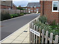
Ensbury Park: Newbury Drive
A very short road within the mid-70s Slades Farm council estate, comprising terraces of narrow houses on each side, stretching much further than the roadway and with a grass square making up the difference (beyond the green campervan).
When the estate first appeared on local street maps, only its 'parent' road, Hibberd Way, was named, and I wonder whether the intention initially was that these houses be numbered in that road, rather than as a separate road.
The sign is a modern one, from 2010-15 when this more modern, abstract emblem rather than the traditional town coat of arms as the working logo of the council.
This is photo no.289 of a series of 453 in my coronavirus lockdown walking project:
See https://www.geograph.org.uk/article/My-2020-Coronavirus-Lockdown-walking-project for the complete set of photos.
Image: © Chris Downer
Taken: 14 Apr 2020
0.03 miles
2
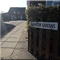
Ensbury Park: Glenmoor Gardens
A modern infill development behind Ensbury Avenue. The virtually unbroken line of houses is split into three in terms of address and access, with the more or less identical Hartmoor Gardens and Ensbury Gardens adjacent to the north.
The sign is small and nonstandard and, therefore, presumably erected by the developer rather than the council.
This is photo no.165 of a series of 453 in my coronavirus lockdown walking project:
See https://www.geograph.org.uk/article/My-2020-Coronavirus-Lockdown-walking-project for the complete set of photos.
Image: © Chris Downer
Taken: 13 Apr 2020
0.04 miles
3
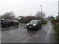
Ensbury Park: the dead end of Hibberd Way
This short cul-de-sac comes to an end on a rectangular green, three sides of which have public footpaths running along them.
Footpath N32 heads left, along the route signposted to the odd numbered houses, and also continues ahead to the dead end of Cornish Gardens, where we can see a couple of parked cars.
See Image] for the view along the path to the left, and Image for the next view on the path ahead.
Image: © Chris Downer
Taken: 14 Feb 2017
0.04 miles
4
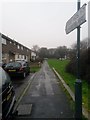
Ensbury Park: to odds 1-7 Hibberd Way
From the dead end of Hibberd Way, we look along a path to the frontages of odd numbers 1-7. There are more houses than that, though, as the row continues as evens 18-24 Cornish Gardens, which is the road in the distance.
The path is a designated public right of way, public footpath N32, whose course heads right just here to the dead end of Cornish Gardens.
See Image for the view along the path from the far end, and Image for a wider view of this spot, with a view along the continuing path to the right.
Image: © Chris Downer
Taken: 14 Feb 2017
0.04 miles
5

Ensbury Park: Hibberd Way
One of the roads of the 1970s Slades Farm council estate, which suffers from that strange symptom of 70s estates whereby the houses have confusing numbers because they are built facing footpaths at right angles to the road. Further along, the terrace on the right morphs into Cornish Gardens addresses at the dead end of the latter.
The sign is a modern one, from 2010-15 when this more modern, abstract emblem rather than the traditional town coat of arms as the working logo of the council.
This is photo no.195 of a series of 453 in my coronavirus lockdown walking project:
See https://www.geograph.org.uk/article/My-2020-Coronavirus-Lockdown-walking-project for the complete set of photos.
Image: © Chris Downer
Taken: 13 Apr 2020
0.05 miles
6
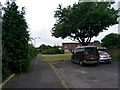
Ensbury Park: eastern segment of footpath N32
This public right of way is essentially an extension of the pavement of Cornish Gardens, here at its dead end. It proceeds straight ahead of us, joining the pavement at the dead end of Hibberd Way, whereupon it turns right, in front of the houses in the background, and continues back onto the main carriageway of Cornish Gardens.
See Image for a view towards us from the far end, with links to photos on the other leg of the path.
Meanwhile, just ahead of us, by the tree, another path heads along this nearer edge of the green: Image
Image: © Chris Downer
Taken: 15 Jun 2016
0.05 miles
7
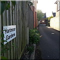
Ensbury Park: Hartmoor Gardens
A modern infill development behind Ensbury Avenue. The virtually unbroken line of houses is split into three in terms of address and access, with the more or less identical Glenmoor Gardens to the south and Ensbury Gardens to the north.
The sign is small and nonstandard and, therefore, presumably erected by the developer rather than the council.
This is photo no.181 of a series of 453 in my coronavirus lockdown walking project:
See https://www.geograph.org.uk/article/My-2020-Coronavirus-Lockdown-walking-project for the complete set of photos.
Image: © Chris Downer
Taken: 13 Apr 2020
0.05 miles
8
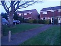
Ensbury Park: footpaths N32 and N33 meet
The rectangular green on which we stand has public footpaths running along three of its edges. Footpath N32 runs from the dead end of Cornish Gardens (visible left) along the frontages of the houses in front of us, and then continues around the southern edge. Meanwhile, footpath N33 runs behind us along the northern edge.
See:
Image for the view along path N32 (to the right) from the dead end ahead;
Image for the reciprocal view along path N32 from the right; and
Image for the view behind us along path N33.
Image: © Chris Downer
Taken: 13 Feb 2017
0.05 miles
9
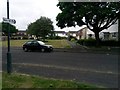
Ensbury Park: western segment of footpath N32
Looking across Cornish Gardens to even numbers 18-24 (and odds 1-7 Hibberd Way beyond them), in front of which runs this public footpath. The course of footpath N32 then turns left, in front of the houses in the background (see Image] for the next view on the footpath).
Along the left-hand edge of the rectangular green runs a similar footpath, N33, in front of even numbers 26-34. See Image
Image: © Chris Downer
Taken: 15 Jun 2016
0.05 miles