IMAGES TAKEN NEAR TO
Walton Road, BOURNEMOUTH, BH10 4BJ
Introduction
This page details the photographs taken nearby to Walton Road, BH10 4BJ by members of the Geograph project.
The Geograph project started in 2005 with the aim of publishing, organising and preserving representative images for every square kilometre of Great Britain, Ireland and the Isle of Man.

There are currently over 7.5m images from over14,400 individuals and you can help contribute to the project by visiting https://www.geograph.org.uk
Image Map
Images are licensed for reuse under creativecommons.org/licenses/by-sa/2.0
Notes
- Clicking on the map will re-center to the selected point.
- The higher the marker number, the further away the image location is from the centre of the postcode.
Image Listing (170 Images Found)
Images are licensed for reuse under creativecommons.org/licenses/by-sa/2.0
Image
Details
Distance
1
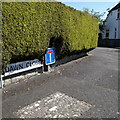
Ensbury Park: Dawn Close
Dawn Close, like many of the roads around here, consists of desirable bungalows and its corner has a widened triangular piece of tarmac which limits our view along the road at the same time as seeing the sign.
The sign is the standard Bournemouth nameplate from the 1980s, affixed with tubular steel which protrudes at each side. The use of a full-size no-through-road sign on a short post alongside the nameplate is quite a common arrangement in Bournemouth.
This is photo no.100 of a series of 453 in my coronavirus lockdown walking project:
See https://www.geograph.org.uk/article/My-2020-Coronavirus-Lockdown-walking-project for the complete set of photos.
Image: © Chris Downer
Taken: 14 Apr 2020
0.03 miles
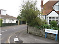
3
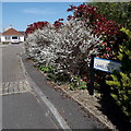
Ensbury Park: Camellia Gardens
A modern infill development of bungalows off Dawn Close, itself a no-through road.
The sign is a modern one, from 2010-15 when this more modern, abstract emblem rather than the traditional town coat of arms as the working logo of the council.
This is photo no.58 of a series of 453 in my coronavirus lockdown walking project:
See https://www.geograph.org.uk/article/My-2020-Coronavirus-Lockdown-walking-project for the complete set of photos.
Image: © Chris Downer
Taken: 14 Apr 2020
0.05 miles
4
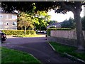
Ensbury Park: footpath N08 crosses Walton Road diagonally
This historic public footpath route was diverted at this northern end when the Slades Farm housing estate was built. Here, we see it in the form of a suburban path, crossing Walton Road to follow the pavement of Forsyth Gardens before eventually crossing the playing fields.
See Image for the next view along the path ahead, and Image for the next view behind us, each with links to further photos along the length of the route.
Image: © Chris Downer
Taken: 3 Jul 2016
0.05 miles
5
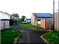
Ensbury Park: footpath N08 heads for Columbia Road
This original public footpath has been rerouted somewhat to accommodate the building of the Slades Farm estate, of which these houses at a dead end of Singleton Drive are part. Its diversion is even more noticeable behind us.
See Image for the next view along the path ahead, and Image for the next view behind us, each with links to further photos along the whole length of the route.
Image: © Chris Downer
Taken: 3 Jul 2016
0.05 miles
6
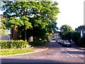
Ensbury Park: footpath N08 follows Forsyth Gardens
This public footpath was rerouted somewhat when the Slades Farm estate was built, and this section now follows the left-hand pavement of Forsyth Gardens, from here in Walton Road to the playing fields behind.
See Image for the continuing path just behind us, and Image for its continuation to the playing fields ahead - each has links to further photos along the whole length of the path.
Image: © Chris Downer
Taken: 3 Jul 2016
0.06 miles
7
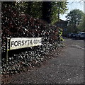
Ensbury Park: Forsyth Gardens
A cul-de-sac on the very fringe of the 1970s Slades Farm council estate, featuring a few three-storey blocks of flats such as the one in the background, which backs onto Slades Farm Open Space.
The sign is the standard Bournemouth nameplate from the 1980s, affixed with tubular steel which protrudes at each side.
This is photo no.147 of a series of 453 in my coronavirus lockdown walking project:
See https://www.geograph.org.uk/article/My-2020-Coronavirus-Lockdown-walking-project for the complete set of photos.
Image: © Chris Downer
Taken: 13 Apr 2020
0.06 miles
8
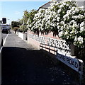
Ensbury Park: Cove Road
In this view along the northern pavement of Cove Road, we can just glimpse the mainly detached houses along this mid-length cul-de-sac. This is in contrast to the bungalows in most of the immediately surrounding roads.
The sign is the standard Bournemouth nameplate from the 1980s, affixed with tubular steel which protrudes at each side.
This is photo no.90 of a series of 453 in my coronavirus lockdown walking project:
See https://www.geograph.org.uk/article/My-2020-Coronavirus-Lockdown-walking-project for the complete set of photos.
Image: © Chris Downer
Taken: 14 Apr 2020
0.06 miles
9

Ensbury Park: footpath N22 heads for Talbot Rise
A man walks his two dogs along this public footpath along the northern edge of Slades Farm playing fields, bound for Talbot Rise. He has just crossed a tiny bridge over a minor stream or drainage ditch.
See Image for a view towards us from the end of the path ahead, and Image for the next view of the path behind us, as it crosses another. These links provide further links to photos along the mentioned routes.
Image: © Chris Downer
Taken: 9 Jul 2016
0.07 miles