IMAGES TAKEN NEAR TO
Shay Grange, BRADFORD, BD9 6RD
Introduction
This page details the photographs taken nearby to Shay Grange, BD9 6RD by members of the Geograph project.
The Geograph project started in 2005 with the aim of publishing, organising and preserving representative images for every square kilometre of Great Britain, Ireland and the Isle of Man.

There are currently over 7.5m images from over14,400 individuals and you can help contribute to the project by visiting https://www.geograph.org.uk
Image Map
Images are licensed for reuse under creativecommons.org/licenses/by-sa/2.0
Notes
- Clicking on the map will re-center to the selected point.
- The higher the marker number, the further away the image location is from the centre of the postcode.
Image Listing (22 Images Found)
Images are licensed for reuse under creativecommons.org/licenses/by-sa/2.0
Image
Details
Distance
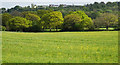
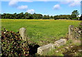
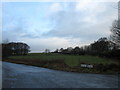
3
Buttercup-covered field seen from Long Lane, Shipley
Image: © habiloid
Taken: 6 Jun 2013
0.10 miles
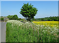
4
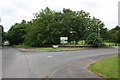
Junction of Long Lane and The Fairways
Ordnance Survey documents indicate that in 1957 a benchmark levelled at 188.799m above Newlyn Datum was verified on a gatepost at a track entrance here. That was before The Fairways was constructed.
Image: © Roger Templeman
Taken: 30 May 2017
0.11 miles
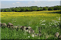
6
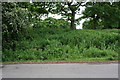
Roadside vegetation beside Shay Lane concealing a water trough
There is an Ordnance Survey benchmark Image on the trough about 2 feet from its left hand end, where some of the vegetation has been cut back
Image: © Roger Templeman
Taken: 30 May 2017
0.12 miles
7
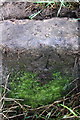
Benchmark on trough on south side of Shay Lane at a bend
Ordnance Survey rivet benchmark described on the Bench Mark Database at www.bench-marks.org.uk/bm80310
Image: © Roger Templeman
Taken: 30 May 2017
0.13 miles
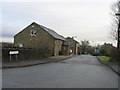
10
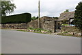
Buildings at Shay Farm, Long Lane/ShayLane junction
Ordnance Survey documents indicate that in 1957 a benchmark levelled at 178.079m above Newlyn Datum was verified on the outbuilding at 1.5m from its near angle, so could be lost behind the telegraph pole.
Image: © Roger Templeman
Taken: 30 May 2017
0.15 miles