IMAGES TAKEN NEAR TO
Rockland Crescent, BRADFORD, BD7 2SN
Introduction
This page details the photographs taken nearby to Rockland Crescent, BD7 2SN by members of the Geograph project.
The Geograph project started in 2005 with the aim of publishing, organising and preserving representative images for every square kilometre of Great Britain, Ireland and the Isle of Man.

There are currently over 7.5m images from over14,400 individuals and you can help contribute to the project by visiting https://www.geograph.org.uk
Image Map
Images are licensed for reuse under creativecommons.org/licenses/by-sa/2.0
Notes
- Clicking on the map will re-center to the selected point.
- The higher the marker number, the further away the image location is from the centre of the postcode.
Image Listing (79 Images Found)
Images are licensed for reuse under creativecommons.org/licenses/by-sa/2.0
Image
Details
Distance
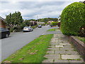
1
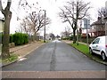
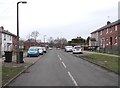
Scholemoor Avenue
Parking strips have replaced the grass verges, but the trees have been retained.
Image: © Humphrey Bolton
Taken: 4 Feb 2013
0.03 miles
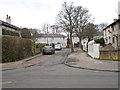
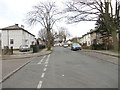
3
Woodvale Way at Clayton, Bradford
Looking north-westward.
Image: © Peter Wood
Taken: 28 Aug 2018
0.06 miles
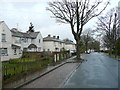
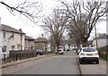
7
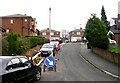
Scholemoor Avenue - viewed from Brooksbank Avenue
Image: © Betty Longbottom
Taken: 14 Feb 2012
0.07 miles
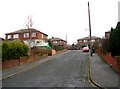
9
Brooksbank Avenue - viewed from Ashton Avenue
Image: © Betty Longbottom
Taken: 14 Feb 2012
0.10 miles