IMAGES TAKEN NEAR TO
Ramsden Avenue, BRADFORD, BD7 2RR
Introduction
This page details the photographs taken nearby to Ramsden Avenue, BD7 2RR by members of the Geograph project.
The Geograph project started in 2005 with the aim of publishing, organising and preserving representative images for every square kilometre of Great Britain, Ireland and the Isle of Man.

There are currently over 7.5m images from over14,400 individuals and you can help contribute to the project by visiting https://www.geograph.org.uk
Image Map
Images are licensed for reuse under creativecommons.org/licenses/by-sa/2.0
Notes
- Clicking on the map will re-center to the selected point.
- The higher the marker number, the further away the image location is from the centre of the postcode.
Image Listing (70 Images Found)
Images are licensed for reuse under creativecommons.org/licenses/by-sa/2.0
Image
Details
Distance
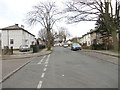
3
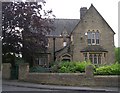
Lodge at Scholemoor Cemetery & Crematorium
Image: © Betty Longbottom
Taken: 5 Jun 2007
0.03 miles
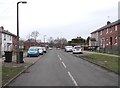
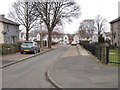
6
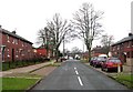
Brooksbank Avenue - viewed from Ashton Avenue
Image: © Betty Longbottom
Taken: 14 Feb 2012
0.05 miles
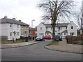
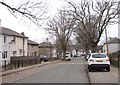
7
Scholemoor Avenue - viewed from Brooksbank Avenue
Image: © Betty Longbottom
Taken: 14 Feb 2012
0.07 miles
8
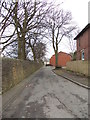
Brooksbank Avenue - ending in Footpath
Image: © Betty Longbottom
Taken: 14 Feb 2012
0.08 miles
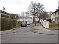
10
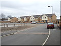
Un-named Road - off Dracup Avenue
Image: © Betty Longbottom
Taken: 14 Feb 2012
0.09 miles