IMAGES TAKEN NEAR TO
Beckside Road, BRADFORD, BD7 2JS
Introduction
This page details the photographs taken nearby to Beckside Road, BD7 2JS by members of the Geograph project.
The Geograph project started in 2005 with the aim of publishing, organising and preserving representative images for every square kilometre of Great Britain, Ireland and the Isle of Man.

There are currently over 7.5m images from over14,400 individuals and you can help contribute to the project by visiting https://www.geograph.org.uk
Image Map
Images are licensed for reuse under creativecommons.org/licenses/by-sa/2.0
Notes
- Clicking on the map will re-center to the selected point.
- The higher the marker number, the further away the image location is from the centre of the postcode.
Image Listing (105 Images Found)
Images are licensed for reuse under creativecommons.org/licenses/by-sa/2.0
Image
Details
Distance
1
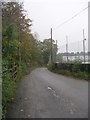
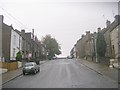
Old Corn Mill Lane - Beckside Road
Image: © Betty Longbottom
Taken: 11 Oct 2011
0.06 miles
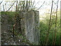
2

Pakistani Foods, Beckside Road, Great Horton
This was part of a foundry, probably the offices.
Image: © Humphrey Bolton
Taken: 19 Aug 2010
0.06 miles
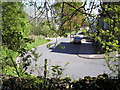
3
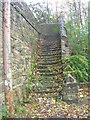
Steps - from Corn Mill Lane to Westcroft Road
Image: © Betty Longbottom
Taken: 11 Oct 2011
0.06 miles
5
Old Corn Mill Lane - Beckside Road
Image: © Betty Longbottom
Taken: 23 Dec 2008
0.07 miles
8
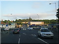
Westcroft Road taken from wasteland
Westcroft Road looking towards junction with Beckside Road, taken from raised ground beneath Great Horton Tesco car park.
Image: © John
Taken: 22 Apr 2016
0.07 miles
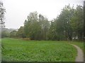
9
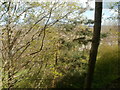
View over dog walking track, Westcroft Road
This photo is taken from a smaller elevation beneath the Tesco car park elevation in Great Horton which forms part of the wasteland beneath the store. Properly fenced to avoid falls (particularly from this section which is a sheer drop down) and with the creation of steps in places, this would make a great public footpath but currently is a scramble for those foolhardy enough to attempt it. Cats love it and love to drag you along behind them! I'm guessing that this smaller elevation was once part of Westcroft Mills before demolition. There are young trees growing on the embankment itself as well as below but angry young people seem to want to take their inner rage out on these, probably following being told off by their parents.
Image: © John
Taken: 23 Apr 2016
0.07 miles
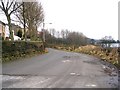
10
Supporting wall for former Westcroft Mills elevation
A rough track on the left of the picture leads to a tree lined plateau on top of this embankment and out of shot on the left is the vast ivy covered wall which forms the elevation for Great Horton Tesco car park. The slope to the right of the wall is strewn with litter through fly-tipping and at the base of the slope is the remains of a tall fence which was clearly once used to secure this site. Clearly this wasn't a success and besides myself, a number of young people use this route to return from football games in the park or generally as a quiet place. I am trying to cultivate patches of the site whilst retaining its wild nature (for which read, there is an enormous thorn tree growing in the middle of this site which is unlikely to be coming up anytime soon...).
Image: © John
Taken: 23 Apr 2016
0.07 miles