IMAGES TAKEN NEAR TO
Henderson Place, BRADFORD, BD6 1PL
Introduction
This page details the photographs taken nearby to Henderson Place, BD6 1PL by members of the Geograph project.
The Geograph project started in 2005 with the aim of publishing, organising and preserving representative images for every square kilometre of Great Britain, Ireland and the Isle of Man.

There are currently over 7.5m images from over14,400 individuals and you can help contribute to the project by visiting https://www.geograph.org.uk
Image Map
Images are licensed for reuse under creativecommons.org/licenses/by-sa/2.0
Notes
- Clicking on the map will re-center to the selected point.
- The higher the marker number, the further away the image location is from the centre of the postcode.
Image Listing (121 Images Found)
Images are licensed for reuse under creativecommons.org/licenses/by-sa/2.0
Image
Details
Distance
1
Quarry Dene - Holroyd Hill
This is an Anchor Housing complex.
Image: © Betty Longbottom
Taken: 23 Jul 2011
0.01 miles

6
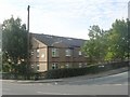
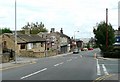
Holroyd Hill
The house nearest the camera, 4 Holroyd Hill, dates from the early 19th century and is grade 2 listed (list entry 1133089) as are several other houses in this area, Wibsey being one of the oldest settlements in the Bradford area.
Image: © Stephen Craven
Taken: 10 Sep 2016
0.04 miles
8
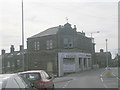
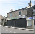
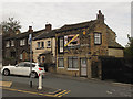
BPIS Ltd - Odsal Road
This former co-operative society building was erected in 1898 - it is now used by International Breakdown.
Image: © Betty Longbottom
Taken: 23 Jul 2011
0.05 miles
9
Canton Girl Chinese Takeaway - Holroyd Hill
Image: © Betty Longbottom
Taken: 23 Jul 2011
0.06 miles
10
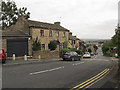
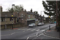
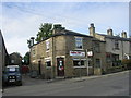
Wibsey Bank
Looking down from the top of the road, the gradient (about 14% or 1:7) is not obvious. But I had just cycled up it and was pausing for breath. There are speed humps to deter drivers from going too fast downhill.
The house on the left, 84 Wibsey Bank, is grade 2 listed (list entry 1290629) as are several other houses in this area, Wibsey being one of the oldest settlements in the Bradford area.
Image: © Stephen Craven
Taken: 10 Sep 2016
0.06 miles