IMAGES TAKEN NEAR TO
Acre Lane, BRADFORD, BD6 1LG
Introduction
This page details the photographs taken nearby to Acre Lane, BD6 1LG by members of the Geograph project.
The Geograph project started in 2005 with the aim of publishing, organising and preserving representative images for every square kilometre of Great Britain, Ireland and the Isle of Man.

There are currently over 7.5m images from over14,400 individuals and you can help contribute to the project by visiting https://www.geograph.org.uk
Image Map
Images are licensed for reuse under creativecommons.org/licenses/by-sa/2.0
Notes
- Clicking on the map will re-center to the selected point.
- The higher the marker number, the further away the image location is from the centre of the postcode.
Image Listing (75 Images Found)
Images are licensed for reuse under creativecommons.org/licenses/by-sa/2.0
Image
Details
Distance
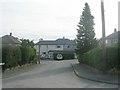
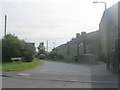
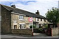
2
Acre Lane - looking towards High Street
Image: © Betty Longbottom
Taken: 23 Jul 2011
0.04 miles
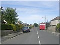
6
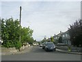
Northfield Grove - Northfield Road
Image: © Betty Longbottom
Taken: 23 Jul 2011
0.06 miles
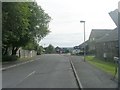
7
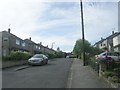
Northfield Grove - looking towards Northfield Road
Image: © Betty Longbottom
Taken: 23 Jul 2011
0.07 miles
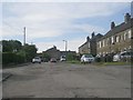
8
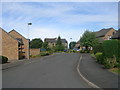
The Meadows - looking towards Acre Lane
Image: © Betty Longbottom
Taken: 23 Jul 2011
0.07 miles
9
Chapel Street
The date stone above the door of the first house reads 1753.
Image: © Betty Longbottom
Taken: 18 Jul 2007
0.08 miles
10
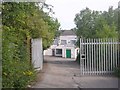
Yorkshire Dales Bakery - off Acre Lane
Image: © Betty Longbottom
Taken: 23 Jul 2011
0.09 miles