IMAGES TAKEN NEAR TO
Cranbrook Avenue, BRADFORD, BD6 1JF
Introduction
This page details the photographs taken nearby to Cranbrook Avenue, BD6 1JF by members of the Geograph project.
The Geograph project started in 2005 with the aim of publishing, organising and preserving representative images for every square kilometre of Great Britain, Ireland and the Isle of Man.

There are currently over 7.5m images from over14,400 individuals and you can help contribute to the project by visiting https://www.geograph.org.uk
Image Map
Images are licensed for reuse under creativecommons.org/licenses/by-sa/2.0
Notes
- Clicking on the map will re-center to the selected point.
- The higher the marker number, the further away the image location is from the centre of the postcode.
Image Listing (80 Images Found)
Images are licensed for reuse under creativecommons.org/licenses/by-sa/2.0
Image
Details
Distance
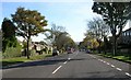
3
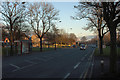
Halifax Road
Taken at around 3:30pm with the sun very low in the sky.
Image: © Mark Anderson
Taken: 1 Dec 2012
0.06 miles
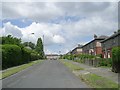
6
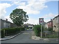
Ormondroyd Avenue - Southfield Avenue
Image: © Betty Longbottom
Taken: 5 Aug 2011
0.07 miles
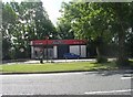
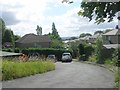
9
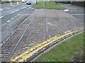
Tram Tracks across Netherlands Avenue, Odsal
Between the two world wars Bradford Corporation embarked on a large programme of road building and widening, and here Halifax road was widened and the tram lines moved to a side reservation. This is now mostly a grass verge, but the tracks and stone setts are still visible as they cross the top of Netherlands Avenue. This line was originally that of the Bradford and Shelf Tramway Company, operated by steam. Bradford Corporation took this over in 1902, and converted the line to electric traction. By 1935 the track had deteriorated, and was closed. However the track to Horsfall Playing Fields at SE148293, including the rails in this image, was renewed and was not closed until 1950. (D M Coates, Bradford City Tramways 1882-1950)
Image: © Humphrey Bolton
Taken: 8 Feb 2010
0.10 miles
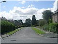
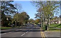
10
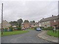
Carisbrooke Crescent - Ormondroyd Avenue
Image: © Betty Longbottom
Taken: 17 Oct 2011
0.11 miles