
IMAGES TAKEN NEAR TO
Bailey Wells Avenue, BRADFORD, BD5 9EA
Introduction
This page details the photographs taken nearby to Bailey Wells Avenue, BD5 9EA by members of the Geograph project.
The Geograph project started in 2005 with the aim of publishing, organising and preserving representative images for every square kilometre of Great Britain, Ireland and the Isle of Man.

There are currently over 7.5m images from over14,400 individuals and you can help contribute to the project by visiting https://www.geograph.org.uk
Image Map
Images are licensed for reuse under creativecommons.org/licenses/by-sa/2.0
Notes
- Clicking on the map will re-center to the selected point.
- The higher the marker number, the further away the image location is from the centre of the postcode.
Image Listing (148 Images Found)
Images are licensed for reuse under creativecommons.org/licenses/by-sa/2.0
Image
Details
Distance
1
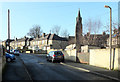
Bailey Wells Avenue
The spire of St. Oswald's Church can also be seen.
Image: © habiloid
Taken: 8 Feb 2020
0.02 miles
2
Bailey Wells Avenue - Thornton Lane
Image: © Betty Longbottom
Taken: 22 Dec 2008
0.04 miles
4
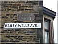
Old and modern street name plate, Bailey Wells Avenue
Bailey Wells Avenue is a mid-20C street, and old maps do not show a previous street here, so what was the old plate for? It had evidently been used before for Earl Street and for Morley Carr (?). The street map index no longer has an Earl Street in Bradford, but there is a Morley Carr Road.
Image: © Humphrey Bolton
Taken: 21 Oct 2011
0.05 miles
5
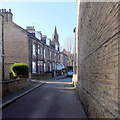
Christopher Terrace
The spire of St. Oswald's Church can be seen in the background.
Image: © habiloid
Taken: 8 Feb 2020
0.05 miles
6
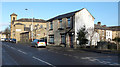
Thornton Lane, Bradford
The building at the end of the street is the Shree Hindu Temple and Community Centre.
Image: © habiloid
Taken: 8 Feb 2020
0.05 miles
7
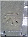
Ordnance Survey Cut Mark
This can be found on the wall of St Oswald's Church.
For more detail see : http://www.bench-marks.org.uk/bm52275
Image: © Peter Wood
Taken: 7 Oct 2013
0.05 miles
8
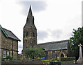
Bradford - St Oswald's vicarage, church and war memorial
Image: © Dave Bevis
Taken: 29 Jun 2013
0.05 miles
9
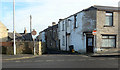
Independent Street, Bradford
Independent Street seen from Thornton Lane.
Image: © habiloid
Taken: 8 Feb 2020
0.05 miles
10
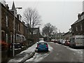
Christopher Terrace, Little Horton
The war memorial by St. Oswald's Church is in the centre of shot.
Image: © Stephen Armstrong
Taken: 10 Dec 2017
0.05 miles