
IMAGES TAKEN NEAR TO
Newhall Way, BRADFORD, BD5 8FE
Introduction
This page details the photographs taken nearby to Newhall Way, BD5 8FE by members of the Geograph project.
The Geograph project started in 2005 with the aim of publishing, organising and preserving representative images for every square kilometre of Great Britain, Ireland and the Isle of Man.

There are currently over 7.5m images from over14,400 individuals and you can help contribute to the project by visiting https://www.geograph.org.uk
Image Map
Images are licensed for reuse under creativecommons.org/licenses/by-sa/2.0
Notes
- Clicking on the map will re-center to the selected point.
- The higher the marker number, the further away the image location is from the centre of the postcode.
Image Listing (54 Images Found)
Images are licensed for reuse under creativecommons.org/licenses/by-sa/2.0
Image
Details
Distance
2
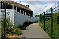
Path between Newhall Way and Rooley Lane
All though using a comparatively new OS Explorer Map, it is already totally out of date due to much building of industrial units around Newhall Way.
This path connects the estate to the A6177, Rooley Lane.
Image: © Chris Heaton
Taken: 15 Jun 2017
0.08 miles
4
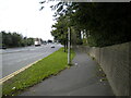
Footpath along Rooley Lane, Bierley
Looking towards Odsal from the junction with Yorkshire Drive.
Image: © Richard Vince
Taken: 15 Sep 2022
0.08 miles
5
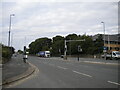
Rooley Lane, Bierley
Part of Bradford's outer ring road, looking towards Odsal from its eastern junction with Newhall Way.
Image: © Richard Vince
Taken: 15 Sep 2022
0.08 miles
7
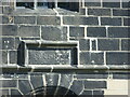
Date stone above the door of Newhall, Bradford
Taken, with lots of zoom, from 40+ metres away on Newhall Way. See Image
Image: © Stephen Armstrong
Taken: 15 May 2018
0.09 miles
8
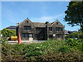
Newhall, Rooley Lane
Grade II Listed late C17. This was the former West Bowling Golf Club Clubhouse, until the golf course was ripped up and replaced by a gigantic Marks & Spencer distribution centre. This view of the frontage is from Newhall Way. There is a date stone above the doorway with the inscription "RRER 1672" referring to the builder and his wife Richard & Elizabeth Richardson.
Image: © Stephen Armstrong
Taken: 15 May 2018
0.09 miles
9
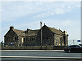
New Hall, Rooley Lane, Bradford
Described by Historic England as a "fine late C17 hall, built by the Richardson family, whose ancestral seat was Bierley Hall". It was latterly the clubhouse of West Bowling golf club, but the club has closed, the course has become Prologic Business Park, and despite being located right on what is now the ring road, the hall appears vacant. Grade II* listed (list entry 1314521). See Image for the other side.
Image: © Stephen Craven
Taken: 10 Aug 2020
0.09 miles
10
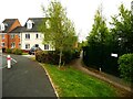
Footpath leaving Newhall Park Drive, North Bierley
This leads to a path around a playing field and a new nature area from which you can go into Bierley Hall Wood.
Image: © Humphrey Bolton
Taken: 28 Apr 2022
0.10 miles