IMAGES TAKEN NEAR TO
Evens Terrace, BRADFORD, BD5 8EJ
Introduction
This page details the photographs taken nearby to Evens Terrace, BD5 8EJ by members of the Geograph project.
The Geograph project started in 2005 with the aim of publishing, organising and preserving representative images for every square kilometre of Great Britain, Ireland and the Isle of Man.

There are currently over 7.5m images from over14,400 individuals and you can help contribute to the project by visiting https://www.geograph.org.uk
Image Map
Images are licensed for reuse under creativecommons.org/licenses/by-sa/2.0
Notes
- Clicking on the map will re-center to the selected point.
- The higher the marker number, the further away the image location is from the centre of the postcode.
Image Listing (90 Images Found)
Images are licensed for reuse under creativecommons.org/licenses/by-sa/2.0
Image
Details
Distance
2
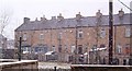
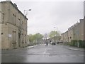
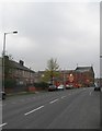
Terraced housing in West Bowling, Bradford
Properties such as these are being "spruced up" with the help of regeneration grants.
Image: © John Constantinoff
Taken: 18 Jan 2005
0.02 miles
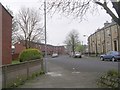
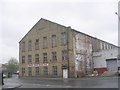
3
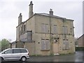
Disused Public House (name unknown) - Parkside Road
Image: © Betty Longbottom
Taken: 11 Apr 2011
0.03 miles
4
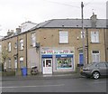
Attock Halal Meat - Murgatroyd Street
Image: © Betty Longbottom
Taken: 11 Apr 2011
0.03 miles
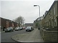
9
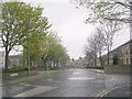
Newroyd Street - viewed from Clipstone Street
Image: © Betty Longbottom
Taken: 11 Apr 2011
0.05 miles