IMAGES TAKEN NEAR TO
Opheilia Close, BRADFORD, BD5 7LG
Introduction
This page details the photographs taken nearby to Opheilia Close, BD5 7LG by members of the Geograph project.
The Geograph project started in 2005 with the aim of publishing, organising and preserving representative images for every square kilometre of Great Britain, Ireland and the Isle of Man.

There are currently over 7.5m images from over14,400 individuals and you can help contribute to the project by visiting https://www.geograph.org.uk
Image Map (Loading...)


Getting Data...Please wait
Leaflet Map data © OpenStreetMap
Images are licensed for reuse under creativecommons.org/licenses/by-sa/2.0
Notes
- Clicking on the map will re-center to the selected point.
- The higher the marker number, the further away the image location is from the centre of the postcode.
Image Listing (172 Images Found)
Images are licensed for reuse under creativecommons.org/licenses/by-sa/2.0
Image
Details
Distance
1
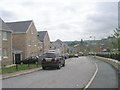
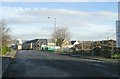
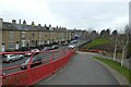
Crocuses near Queensfield Drive
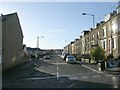
Looking along Hutson Street with NCN66 using the path alongside.
Image: © DS Pugh
Taken: 25 Feb 2023
0.03 miles
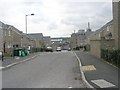
4
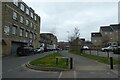
New Housing Development - Park Lane
Image: © Betty Longbottom
Taken: 22 Dec 2008
0.04 miles
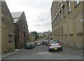
7
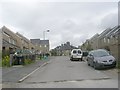
Hutson street - viewed from Queensfield Drive
Image: © Betty Longbottom
Taken: 2 Aug 2011
0.04 miles
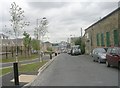
8
Bridge ramp from Trident Park
The access ramp onto the bridge carrying NCN66 over Manchester Road.
Image: © DS Pugh
Taken: 25 Feb 2023
0.05 miles
9
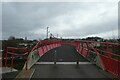
Trident Way Bridge
Carrying NCN66 over Manchester Road.
Image: © DS Pugh
Taken: 25 Feb 2023
0.05 miles