IMAGES TAKEN NEAR TO
Dulverton Grove, BRADFORD, BD4 9EE
Introduction
This page details the photographs taken nearby to Dulverton Grove, BD4 9EE by members of the Geograph project.
The Geograph project started in 2005 with the aim of publishing, organising and preserving representative images for every square kilometre of Great Britain, Ireland and the Isle of Man.

There are currently over 7.5m images from over14,400 individuals and you can help contribute to the project by visiting https://www.geograph.org.uk
Image Map
Images are licensed for reuse under creativecommons.org/licenses/by-sa/2.0
Notes
- Clicking on the map will re-center to the selected point.
- The higher the marker number, the further away the image location is from the centre of the postcode.
Image Listing (98 Images Found)
Images are licensed for reuse under creativecommons.org/licenses/by-sa/2.0
Image
Details
Distance
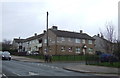
3
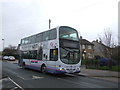
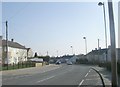
First bus on Holmewood Road, Bradford
On the 618 route.
Image: © JThomas
Taken: 14 Feb 2020
0.03 miles
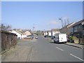
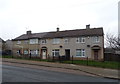
4
House on Holmewood Road, Bradford
Junction with Grayswood Crescent.
Image: © JThomas
Taken: 14 Feb 2020
0.03 miles
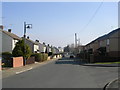
6
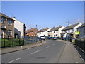
Grayswood Crescent - Holme Wood Road
Image: © Betty Longbottom
Taken: 8 Mar 2011
0.05 miles
8
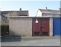
Electricity Substation No 440 - Grayswood Drive
Image: © Betty Longbottom
Taken: 8 Mar 2011
0.06 miles
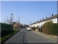
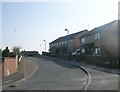
9
Holme Wood Road - viewed from Grayswood Crescent
Image: © Betty Longbottom
Taken: 8 Mar 2011
0.06 miles