IMAGES TAKEN NEAR TO
Broadstone Way, BRADFORD, BD4 9BN
Introduction
This page details the photographs taken nearby to Broadstone Way, BD4 9BN by members of the Geograph project.
The Geograph project started in 2005 with the aim of publishing, organising and preserving representative images for every square kilometre of Great Britain, Ireland and the Isle of Man.

There are currently over 7.5m images from over14,400 individuals and you can help contribute to the project by visiting https://www.geograph.org.uk
Image Map
Images are licensed for reuse under creativecommons.org/licenses/by-sa/2.0
Notes
- Clicking on the map will re-center to the selected point.
- The higher the marker number, the further away the image location is from the centre of the postcode.
Image Listing (92 Images Found)
Images are licensed for reuse under creativecommons.org/licenses/by-sa/2.0
Image
Details
Distance
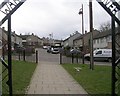
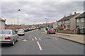
1
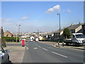
Broadstone Way - viewed from Horsham Road
Image: © Betty Longbottom
Taken: 14 Mar 2011
0.02 miles
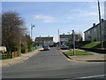
2
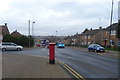
Broadstone Way, Bradford
Showing position of Postbox No. BD4 145.
See Image] for postbox.
Image: © JThomas
Taken: 14 Feb 2020
0.02 miles
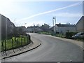
5
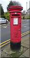
Elizabeth II postbox on Broadstone Way, Bradford
Postbox No. BD4 145.
See Image] for context.
Image: © JThomas
Taken: 14 Feb 2020
0.05 miles
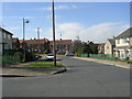
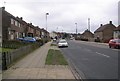
10
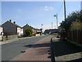
Felcourt Drive - viewed from Muirhead Drive
Image: © Betty Longbottom
Taken: 14 Mar 2011
0.07 miles