IMAGES TAKEN NEAR TO
St. Dunstans Technology Park, BRADFORD, BD4 7HH
Introduction
This page details the photographs taken nearby to St. Dunstans Technology Park, BD4 7HH by members of the Geograph project.
The Geograph project started in 2005 with the aim of publishing, organising and preserving representative images for every square kilometre of Great Britain, Ireland and the Isle of Man.

There are currently over 7.5m images from over14,400 individuals and you can help contribute to the project by visiting https://www.geograph.org.uk
Image Map (Loading...)


Getting Data...Please wait
Leaflet Map data © OpenStreetMap
Images are licensed for reuse under creativecommons.org/licenses/by-sa/2.0
Notes
- Clicking on the map will re-center to the selected point.
- The higher the marker number, the further away the image location is from the centre of the postcode.
Image Listing (127 Images Found)
Images are licensed for reuse under creativecommons.org/licenses/by-sa/2.0
Image
Details
Distance
1
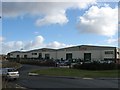
Kings Security Systems, Ripley Street, Bradford
Image: © Stephen Armstrong
Taken: 1 Apr 2010
0.02 miles
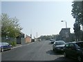
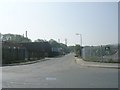
3
Bolling Road - viewed from Ripley Street
Image: © Betty Longbottom
Taken: 19 Apr 2011
0.03 miles
4
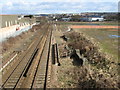
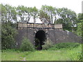
St. Dunstans railway station (site), Bradford, Yorkshire
Opened in 1878 jointly by the Lancashire & Yorkshire Railway and the Great Northern Railway, principally for interchange purposes, this station closed in 1952.
View north towards Bradford. The L&Y Halifax to Bradford lines curved in from bottom left of the image with the platforms under and to the right of the modern building. The GN platforms on the Leeds-Bradford line are out of view in the distance. That railway line is still extant but no trace of the station appears to remain.
For more information, see http://www.disused-stations.org.uk/s/st.dunstan%27s/index.shtml.
Image: © Nigel Thompson
Taken: 9 Jul 2022
0.06 miles
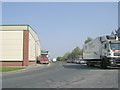
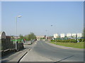
6
View north from Bridge MRB/57, Ripley Street, Bradford
The Bradford Interchange to Halifax line looking towards Bradford.
Image: © Stephen Armstrong
Taken: 1 Apr 2010
0.07 miles
7
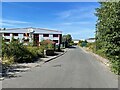
Ripley Street - viewed from Bolling Road
Image: © Betty Longbottom
Taken: 19 Apr 2011
0.08 miles
8
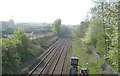
View from Bridge MRB/57 - Ripley Street
Image: © Betty Longbottom
Taken: 19 Apr 2011
0.09 miles
9
Disused Railway Bridge BRB DUH\49
This was on the former GNR Line from Laisterdyke to Bowling Junction (The Bradford Avoiding Line), between Hall Lane Level Crossing and Bowling Viaduct.
Image: © Stephen Armstrong
Taken: 13 Jun 2010
0.10 miles
10
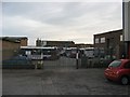
TLC Travel Ltd. Bus Depot, Linton Street
Not much happening at 7.00am on Sunday morning.
Image: © Stephen Armstrong
Taken: 13 Jun 2010
0.10 miles