IMAGES TAKEN NEAR TO
Dawson Lane, BRADFORD, BD4 6JF
Introduction
This page details the photographs taken nearby to Dawson Lane, BD4 6JF by members of the Geograph project.
The Geograph project started in 2005 with the aim of publishing, organising and preserving representative images for every square kilometre of Great Britain, Ireland and the Isle of Man.

There are currently over 7.5m images from over14,400 individuals and you can help contribute to the project by visiting https://www.geograph.org.uk
Image Map
Images are licensed for reuse under creativecommons.org/licenses/by-sa/2.0
Notes
- Clicking on the map will re-center to the selected point.
- The higher the marker number, the further away the image location is from the centre of the postcode.
Image Listing (54 Images Found)
Images are licensed for reuse under creativecommons.org/licenses/by-sa/2.0
Image
Details
Distance
1
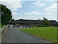
St John's Primary School, Bierley
A Church of England primary school founded in 1857 but only on this site since 2000.
Image: © Stephen Craven
Taken: 4 Jun 2023
0.01 miles
2
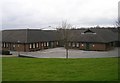
St John's Church of England Primary School - Shetcliffe Lane
Image: © Betty Longbottom
Taken: 23 Feb 2008
0.01 miles
3
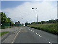
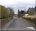
Shetcliffe Lane - viewed from near School
Image: © Betty Longbottom
Taken: 27 Jun 2011
0.05 miles
4
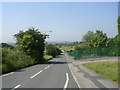
Shetcliffe Lane - viewed from near School
Image: © Betty Longbottom
Taken: 27 Jun 2011
0.06 miles
5
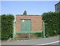
Electricity Substation No 805 - Shetcliffe Lane
Image: © Betty Longbottom
Taken: 27 Jun 2011
0.07 miles
6
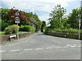
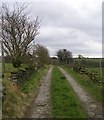
Junction of Shetcloffe Lane and Toftshaw New Road
Toftshaw New Road is closed to through traffic.
Image: © Stephen Craven
Taken: 4 Jun 2023
0.07 miles
7
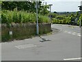
Air valve at the top of Toftshaw New Road
The signage indicates an air valve on a 600m water main (quite a large size, i.e. serving a fairly wide area).
Image: © Stephen Craven
Taken: 4 Jun 2023
0.07 miles
8
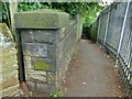
Remains of an old railway footbridge
Old maps show there was a footbridge here taking the footpath between Shetcliffe Lane and Dawson Lane over a railway cutting on the GNR's Gildersome branch, which closed in 1953. Most of the railway land in this area is now occupied by St John's school and industrial premises.
Image: © Stephen Craven
Taken: 4 Jun 2023
0.07 miles
10
Toftshaw New Road - Shetcliffe Lane
Image: © Betty Longbottom
Taken: 23 Feb 2008
0.09 miles