IMAGES TAKEN NEAR TO
Fieldside Close, BRADFORD, BD4 0QY
Introduction
This page details the photographs taken nearby to Fieldside Close, BD4 0QY by members of the Geograph project.
The Geograph project started in 2005 with the aim of publishing, organising and preserving representative images for every square kilometre of Great Britain, Ireland and the Isle of Man.

There are currently over 7.5m images from over14,400 individuals and you can help contribute to the project by visiting https://www.geograph.org.uk
Image Map
Images are licensed for reuse under creativecommons.org/licenses/by-sa/2.0
Notes
- Clicking on the map will re-center to the selected point.
- The higher the marker number, the further away the image location is from the centre of the postcode.
Image Listing (57 Images Found)
Images are licensed for reuse under creativecommons.org/licenses/by-sa/2.0
Image
Details
Distance
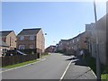
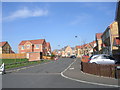
2
Wentworth Crescent - Raikes Avenue
Image: © Betty Longbottom
Taken: 22 Mar 2011
0.04 miles
5
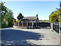
Holme Farm
The main farmhouse seen behind these ornate modern gates is listed grade II (list entry 1133087)
Image: © Stephen Craven
Taken: 2 May 2020
0.06 miles
6
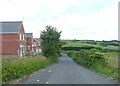
Holme Lane, Tong
Round the corner the lane drops down to Holme.
Image: © Humphrey Bolton
Taken: 18 Jun 2009
0.07 miles
7
Raikes Avenue - viewed from Wentworth Crescent
Image: © Betty Longbottom
Taken: 22 Mar 2011
0.07 miles
8

Electricity Substation No 47988 - Raikes Avenue
Image: © Betty Longbottom
Taken: 14 Mar 2011
0.07 miles
10
Raikes Avenue - viewed from Ryecroft
Image: © Betty Longbottom
Taken: 14 Mar 2011
0.10 miles