IMAGES TAKEN NEAR TO
Stratton View, BRADFORD, BD4 0EF
Introduction
This page details the photographs taken nearby to Stratton View, BD4 0EF by members of the Geograph project.
The Geograph project started in 2005 with the aim of publishing, organising and preserving representative images for every square kilometre of Great Britain, Ireland and the Isle of Man.

There are currently over 7.5m images from over14,400 individuals and you can help contribute to the project by visiting https://www.geograph.org.uk
Image Map
Images are licensed for reuse under creativecommons.org/licenses/by-sa/2.0
Notes
- Clicking on the map will re-center to the selected point.
- The higher the marker number, the further away the image location is from the centre of the postcode.
Image Listing (69 Images Found)
Images are licensed for reuse under creativecommons.org/licenses/by-sa/2.0
Image
Details
Distance
1
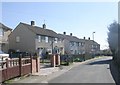
Farway - looking towards Eversley Drive
Image: © Betty Longbottom
Taken: 22 Mar 2011
0.01 miles
6
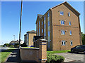
Attlee House, Ned Lane, Tyersal
One of several four-storey housing units along this road, all named after past political leaders (the one beyond it is Chamberlain House).
Image: © Stephen Craven
Taken: 2 May 2020
0.05 miles
7
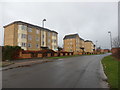
Ex-Council Flats on Ned Lane
Now they are in private ownership they will be classed as apartments.
Image: © Stephen Armstrong
Taken: 28 Jan 2018
0.06 miles