IMAGES TAKEN NEAR TO
Oswaldthorpe Avenue, BRADFORD, BD3 7HQ
Introduction
This page details the photographs taken nearby to Oswaldthorpe Avenue, BD3 7HQ by members of the Geograph project.
The Geograph project started in 2005 with the aim of publishing, organising and preserving representative images for every square kilometre of Great Britain, Ireland and the Isle of Man.

There are currently over 7.5m images from over14,400 individuals and you can help contribute to the project by visiting https://www.geograph.org.uk
Image Map (Loading...)


Getting Data...Please wait
Leaflet Map data © OpenStreetMap
Images are licensed for reuse under creativecommons.org/licenses/by-sa/2.0
Notes
- Clicking on the map will re-center to the selected point.
- The higher the marker number, the further away the image location is from the centre of the postcode.
Image Listing (73 Images Found)
Images are licensed for reuse under creativecommons.org/licenses/by-sa/2.0
Image
Details
Distance
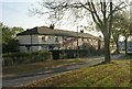
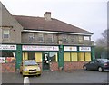
1
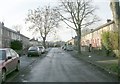
Oswaldthorpe Avenue - Burlington Avenue, Bradford
Image: © Betty Longbottom
Taken: 30 Nov 2008
0.01 miles
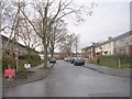
2
Morley Avenue - Oswaldthorpe Avenue, Bradford
Image: © Betty Longbottom
Taken: 30 Nov 2008
0.03 miles
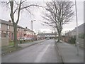
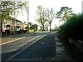
3
Burlington Avenue - Gain Lane, Bradford
Image: © Betty Longbottom
Taken: 30 Nov 2008
0.03 miles
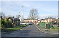
4

Hilmore House, Gain Lane - Morrisons HQ
Image: © Simon McKeating
Taken: 2 Nov 2006
0.06 miles
5
Oswaldthorpe Avenue - Mortimer Avenue
Image: © Betty Longbottom
Taken: 13 Dec 2010
0.08 miles
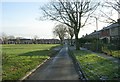
7
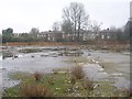
Derelict Land - off Rushton Avenue
Image: © Betty Longbottom
Taken: 12 Feb 2011
0.09 miles
10
Mortimer House Children's Centre - Mortimer Avenue
Image: © Betty Longbottom
Taken: 13 Dec 2010
0.12 miles