IMAGES TAKEN NEAR TO
Leng Drive, BRADFORD, BD3 7FJ
Introduction
This page details the photographs taken nearby to Leng Drive, BD3 7FJ by members of the Geograph project.
The Geograph project started in 2005 with the aim of publishing, organising and preserving representative images for every square kilometre of Great Britain, Ireland and the Isle of Man.

There are currently over 7.5m images from over14,400 individuals and you can help contribute to the project by visiting https://www.geograph.org.uk
Image Map (Loading...)


Getting Data...Please wait
Leaflet Map data © OpenStreetMap
Images are licensed for reuse under creativecommons.org/licenses/by-sa/2.0
Notes
- Clicking on the map will re-center to the selected point.
- The higher the marker number, the further away the image location is from the centre of the postcode.
Image Listing (56 Images Found)
Images are licensed for reuse under creativecommons.org/licenses/by-sa/2.0
Image
Details
Distance
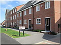
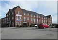
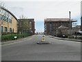
1
Leng Drive - viewed from Carrick Drive
Image: © Betty Longbottom
Taken: 13 Apr 2014
0.04 miles
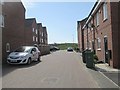
2
Hutton Close - viewed from Chapman Road
Image: © Betty Longbottom
Taken: 13 Apr 2014
0.04 miles
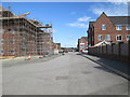
3
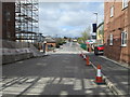
Chapman Road - looking towards Mid Point
Image: © Betty Longbottom
Taken: 13 Apr 2014
0.05 miles
4
Hutton Close - viewed from Chapman Road
Image: © Betty Longbottom
Taken: 13 Apr 2014
0.06 miles
5
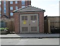
Electricity Substation No 50681 - Chapman Road
Image: © Betty Longbottom
Taken: 13 Apr 2014
0.07 miles
6
Carrick Drive - viewed from Leng Drive
Image: © Betty Longbottom
Taken: 13 Apr 2014
0.07 miles
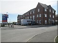
7
Loop Call Centre - Mid Point, Dick Lane
Image: © Betty Longbottom
Taken: 23 Jan 2008
0.08 miles
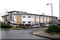
8

Jubilee House - Mid Point, Dick Lane
Image: © Betty Longbottom
Taken: 12 Apr 2009
0.08 miles
9
Chapman Road - viewed from Mid Point
Image: © Betty Longbottom
Taken: 13 Apr 2014
0.08 miles