IMAGES TAKEN NEAR TO
Brackenley Drive, SKIPTON, BD23 6QN
Introduction
This page details the photographs taken nearby to Brackenley Drive, BD23 6QN by members of the Geograph project.
The Geograph project started in 2005 with the aim of publishing, organising and preserving representative images for every square kilometre of Great Britain, Ireland and the Isle of Man.

There are currently over 7.5m images from over14,400 individuals and you can help contribute to the project by visiting https://www.geograph.org.uk
Image Map
Images are licensed for reuse under creativecommons.org/licenses/by-sa/2.0
Notes
- Clicking on the map will re-center to the selected point.
- The higher the marker number, the further away the image location is from the centre of the postcode.
Image Listing (134 Images Found)
Images are licensed for reuse under creativecommons.org/licenses/by-sa/2.0
Image
Details
Distance
1
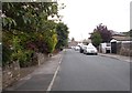
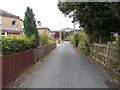
Brackenley Close - Brackenley Drive
Image: © Betty Longbottom
Taken: 17 Aug 2016
0.03 miles
2
Brackenley Grove - Brackenley Drive
Image: © Betty Longbottom
Taken: 17 Aug 2016
0.03 miles
3
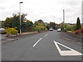
Brackenley Drive - looking towards Skipton Road
Image: © Betty Longbottom
Taken: 17 Aug 2016
0.05 miles
4

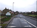
Cyclist entering Embsay
Seen from a heritage train on the preserved Embsay and Bolton Abbey Railway.
Image: © Stephen Craven
Taken: 28 Aug 2023
0.06 miles
5
Brackenley Crescent - Brackenley Drive
Image: © Betty Longbottom
Taken: 17 Aug 2016
0.06 miles
6
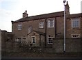
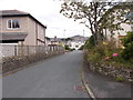
Brackenley Grange
Close to the western edge of Embsay village.
Image: © David Rogers
Taken: 21 Nov 2008
0.06 miles
7
Midgeley Close - Brackenley Crescent
Image: © Betty Longbottom
Taken: 17 Aug 2016
0.07 miles
8
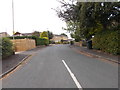
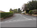
Entering Embsay
Heading north east on Skipton Road.
Image: © JThomas
Taken: 10 Dec 2016
0.07 miles
9
Brackenley Grove - Brackenley Drive
Image: © Betty Longbottom
Taken: 17 Aug 2016
0.08 miles
10
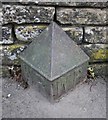
Old Bridge Marker north of Bow Bridge Lower, Skipton Road
Bridge Marker by the UC road, in parish of Embsay with Eastby (Craven District), Bow Bridge Lower, Haw Beck, against stone wall, Southeast side of road.
To be surveyed
Milestone Society National ID: YW_EMB01br
Image: © Roger Templeman
Taken: Unknown
0.08 miles