IMAGES TAKEN NEAR TO
West Royd Avenue, BRADFORD, BD2 2AN
Introduction
This page details the photographs taken nearby to West Royd Avenue, BD2 2AN by members of the Geograph project.
The Geograph project started in 2005 with the aim of publishing, organising and preserving representative images for every square kilometre of Great Britain, Ireland and the Isle of Man.

There are currently over 7.5m images from over14,400 individuals and you can help contribute to the project by visiting https://www.geograph.org.uk
Image Map
Images are licensed for reuse under creativecommons.org/licenses/by-sa/2.0
Notes
- Clicking on the map will re-center to the selected point.
- The higher the marker number, the further away the image location is from the centre of the postcode.
Image Listing (101 Images Found)
Images are licensed for reuse under creativecommons.org/licenses/by-sa/2.0
Image
Details
Distance
1
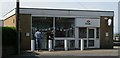
Pine by Design Kitchens & Wardrobes - Idle Road
Image: © Betty Longbottom
Taken: 25 Jan 2011
0.01 miles
6
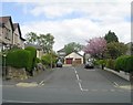
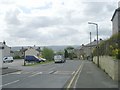
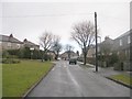
Bolton Drive - viewed from Bolton Crescent
Image: © Betty Longbottom
Taken: 25 Jan 2011
0.05 miles
7
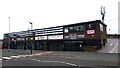
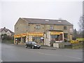
Kingspark Retail Parade, Idle Road, Bradford
Built in the 1970s as a Morrisons Supermarket with a rooftop car park. It is now 7 separate shop units.
Image: © Stephen Armstrong
Taken: 17 Sep 2023
0.06 miles
9
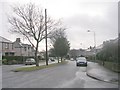
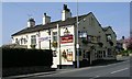
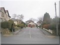
Norman Avenue - viewed from Bolton Crescent
Image: © Betty Longbottom
Taken: 25 Jan 2011
0.06 miles