IMAGES TAKEN NEAR TO
Sinclair Road, BRADFORD, BD2 1QF
Introduction
This page details the photographs taken nearby to Sinclair Road, BD2 1QF by members of the Geograph project.
The Geograph project started in 2005 with the aim of publishing, organising and preserving representative images for every square kilometre of Great Britain, Ireland and the Isle of Man.

There are currently over 7.5m images from over14,400 individuals and you can help contribute to the project by visiting https://www.geograph.org.uk
Image Map
Images are licensed for reuse under creativecommons.org/licenses/by-sa/2.0
Notes
- Clicking on the map will re-center to the selected point.
- The higher the marker number, the further away the image location is from the centre of the postcode.
Image Listing (58 Images Found)
Images are licensed for reuse under creativecommons.org/licenses/by-sa/2.0
Image
Details
Distance
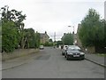
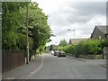
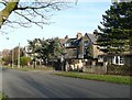
2
Clara Road - viewed from Sinclair Road
Image: © Betty Longbottom
Taken: 11 May 2011
0.04 miles
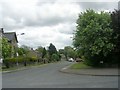
3
Clara Road - viewed from Sinclair Road
Image: © Betty Longbottom
Taken: 11 May 2011
0.05 miles
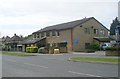
5
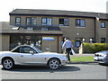
Wrose Health Centre
Wrose Health Centre, Kings Road, Bradford, West Yorkshire, BD2 1QG was opened in the 1980's and originally housed four separate GP practices: Dr Keith Rudd & Dr Michael Neale; Dr Thickett, Dr Margerison & Dr Brian Karet; Dr & Mrs Singh; and Dr Neil Winn's practice. The part of the building in the photograph is now occupied by one large partnership "The Rockwell & Wrose Practice".
Image: © Derek Parkinson
Taken: 5 Apr 2007
0.06 miles
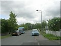
8
Finsbury Drive - viewed from Clara Road
Image: © Betty Longbottom
Taken: 11 May 2011
0.08 miles
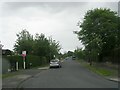
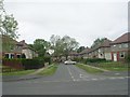
9
Livingstone Road, Bolton, Bradford
This was an ambitious idea, to make a housing estate from Bolton Woods up to Wrose Road. However only the bottom and top sections of the road were constructed, and the land in between was quarried. The house numbers here in the top section are in the 400s. There is an obvious connection between the road names 'Livingstone' and 'Stanley' (which is down in Bolton Woods). The houses with the gables are some of the eight blocks of four, two at the front and two at the rear (facing Clara Road in this case).
Image: © Humphrey Bolton
Taken: 24 Feb 2011
0.09 miles
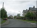
10
Finsbury Drive - Livingstone Road
Image: © Betty Longbottom
Taken: 11 May 2011
0.09 miles