IMAGES TAKEN NEAR TO
Whitechapel Road, CLECKHEATON, BD19 6HR
Introduction
This page details the photographs taken nearby to Whitechapel Road, BD19 6HR by members of the Geograph project.
The Geograph project started in 2005 with the aim of publishing, organising and preserving representative images for every square kilometre of Great Britain, Ireland and the Isle of Man.

There are currently over 7.5m images from over14,400 individuals and you can help contribute to the project by visiting https://www.geograph.org.uk
Image Map
Images are licensed for reuse under creativecommons.org/licenses/by-sa/2.0
Notes
- Clicking on the map will re-center to the selected point.
- The higher the marker number, the further away the image location is from the centre of the postcode.
Image Listing (105 Images Found)
Images are licensed for reuse under creativecommons.org/licenses/by-sa/2.0
Image
Details
Distance
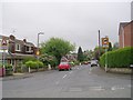
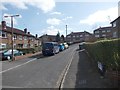
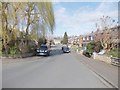
2
Turnsteads Drive - Whitechapel Road
Image: © Betty Longbottom
Taken: 16 May 2009
0.02 miles
3
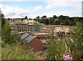
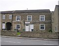
Building site at Moor End, Cleckheaton
Industry gives way to suburbia. The foreground was part of the gas works, and beyond Whitechapel Road, unseen in this view, the land was a tar works. The old houses are on Snelsins Road, and the view is from the Spen Valley Greenway.
Image: © Humphrey Bolton
Taken: 13 Aug 2007
0.05 miles
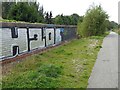
4
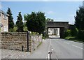
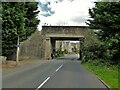
Railway Bridge, Whitechapel Road, Cleckheaton
The railway has been disused since the 1960s, and the bridge now carries Sustrans Route 66 from the Calder valley to Bradford. Beyond the bridge there is a new housing estate on the site of a chemical factory.
Image: © Humphrey Bolton
Taken: 3 Jun 2010
0.05 miles
5
14th Spen Valley Scouts - Whitechapel Road
Image: © Betty Longbottom
Taken: 16 May 2009
0.05 miles
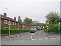
6
Turnsteads Mount - Turnsteads Drive
Image: © Betty Longbottom
Taken: 20 Mar 2012
0.08 miles
9
Spen Valley Greenway Bridge
Marked on OS maps as Flatt Lane Bridge but crosses Whitechapel Road. Spen Valley Greenway follows the route of the former railway from Low Moor to the Calder Valley line south of Dewsbury. This bridge has obviously been replaced - was it for the railway or for its rebirth as National Cycle Network Route 66?
Image: © Kevin Waterhouse
Taken: 16 Aug 2023
0.09 miles
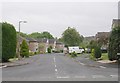
10
Kenmore Road - viewed from Kenmore Avenue
Image: © Betty Longbottom
Taken: 20 Mar 2012
0.09 miles