Spen Valley Greenway Bridge
Introduction
The photograph on this page of Spen Valley Greenway Bridge by Kevin Waterhouse as part of the Geograph project.
The Geograph project started in 2005 with the aim of publishing, organising and preserving representative images for every square kilometre of Great Britain, Ireland and the Isle of Man.

There are currently over 7.5m images from over 14,400 individuals and you can help contribute to the project by visiting https://www.geograph.org.uk
Spen Valley Greenway Bridge
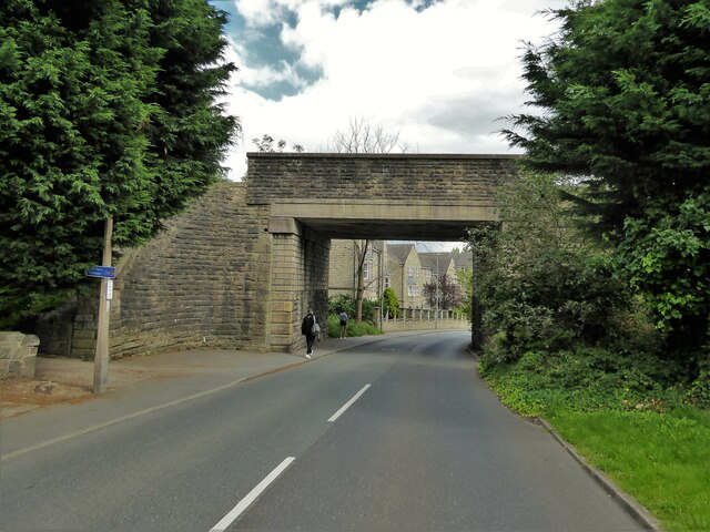
Image: © Kevin Waterhouse Taken: 16 Aug 2023
Marked on OS maps as Flatt Lane Bridge but crosses Whitechapel Road. Spen Valley Greenway follows the route of the former railway from Low Moor to the Calder Valley line south of Dewsbury. This bridge has obviously been replaced - was it for the railway or for its rebirth as National Cycle Network Route 66?
Images are licensed for reuse under creativecommons.org/licenses/by-sa/2.0
Image Location
Latitude
53.73062
Longitude
-1.725005