IMAGES TAKEN NEAR TO
Latham Lane, CLECKHEATON, BD19 4RX
Introduction
This page details the photographs taken nearby to Latham Lane, BD19 4RX by members of the Geograph project.
The Geograph project started in 2005 with the aim of publishing, organising and preserving representative images for every square kilometre of Great Britain, Ireland and the Isle of Man.

There are currently over 7.5m images from over14,400 individuals and you can help contribute to the project by visiting https://www.geograph.org.uk
Image Map
Images are licensed for reuse under creativecommons.org/licenses/by-sa/2.0
Notes
- Clicking on the map will re-center to the selected point.
- The higher the marker number, the further away the image location is from the centre of the postcode.
Image Listing (191 Images Found)
Images are licensed for reuse under creativecommons.org/licenses/by-sa/2.0
Image
Details
Distance
6
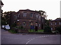
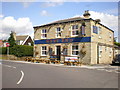
Gomersal Methodist Church
At the top of West Lane. A fine looking Grade 2 Listed building, built in 1827-8, and known locally as the Pork Pie Chapel.
Image: © Stephen Armstrong
Taken: 4 Sep 2005
0.05 miles
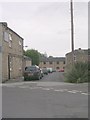
8
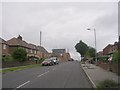
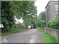
Cliffe Lane - viewed from Latham Lane
Image: © Betty Longbottom
Taken: 31 Jul 2010
0.06 miles