IMAGES TAKEN NEAR TO
Helen Street, SHIPLEY, BD18 4PH
Introduction
This page details the photographs taken nearby to Helen Street, BD18 4PH by members of the Geograph project.
The Geograph project started in 2005 with the aim of publishing, organising and preserving representative images for every square kilometre of Great Britain, Ireland and the Isle of Man.

There are currently over 7.5m images from over14,400 individuals and you can help contribute to the project by visiting https://www.geograph.org.uk
Image Map
Images are licensed for reuse under creativecommons.org/licenses/by-sa/2.0
Notes
- Clicking on the map will re-center to the selected point.
- The higher the marker number, the further away the image location is from the centre of the postcode.
Image Listing (930 Images Found)
Images are licensed for reuse under creativecommons.org/licenses/by-sa/2.0
Image
Details
Distance
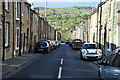
1
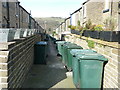
Saltaire back alley
I think the arrangements for refuse disposal have changed greatly over the years.
Image: © Graham Hogg
Taken: 25 Mar 2016
0.01 miles
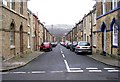
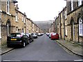
5
William Henry Street - Caroline Street
Image: © Betty Longbottom
Taken: 20 Dec 2008
0.02 miles
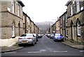
6
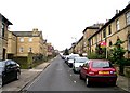
George Street - looking up from Caroline Street
Image: © Betty Longbottom
Taken: 20 Dec 2008
0.02 miles
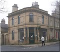
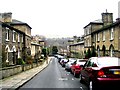
7

Saltaire Orthodontics - Victoria Road
Image: © Betty Longbottom
Taken: 19 Jan 2010
0.02 miles