IMAGES TAKEN NEAR TO
Daisy Place, SHIPLEY, BD18 4NA
Introduction
This page details the photographs taken nearby to Daisy Place, BD18 4NA by members of the Geograph project.
The Geograph project started in 2005 with the aim of publishing, organising and preserving representative images for every square kilometre of Great Britain, Ireland and the Isle of Man.

There are currently over 7.5m images from over14,400 individuals and you can help contribute to the project by visiting https://www.geograph.org.uk
Image Map (Loading...)


Getting Data...Please wait
Leaflet Map data © OpenStreetMap
Images are licensed for reuse under creativecommons.org/licenses/by-sa/2.0
Notes
- Clicking on the map will re-center to the selected point.
- The higher the marker number, the further away the image location is from the centre of the postcode.
Image Listing (703 Images Found)
Images are licensed for reuse under creativecommons.org/licenses/by-sa/2.0
Image
Details
Distance
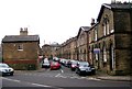
1

Strand hairdressing - Saltaire Road
Image: © Betty Longbottom
Taken: 19 Jan 2010
0.00 miles
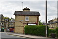
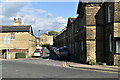
6

Village Estates - Daisy Place, Saltaire Road
Image: © Betty Longbottom
Taken: 19 Jan 2010
0.02 miles
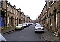
9
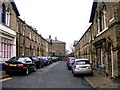
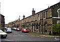
Katherine Street - Upper Mary Street
Image: © Betty Longbottom
Taken: 20 Dec 2008
0.02 miles
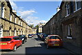
10
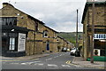
Upper Ada St
All houses are Grade II listed.
Image: © N Chadwick
Taken: 5 May 2019
0.02 miles