IMAGES TAKEN NEAR TO
Castle Mews, SHIPLEY, BD18 3ET
Introduction
This page details the photographs taken nearby to Castle Mews, BD18 3ET by members of the Geograph project.
The Geograph project started in 2005 with the aim of publishing, organising and preserving representative images for every square kilometre of Great Britain, Ireland and the Isle of Man.

There are currently over 7.5m images from over14,400 individuals and you can help contribute to the project by visiting https://www.geograph.org.uk
Image Map (Loading...)


Getting Data...Please wait
Leaflet Map data © OpenStreetMap
Images are licensed for reuse under creativecommons.org/licenses/by-sa/2.0
Notes
- Clicking on the map will re-center to the selected point.
- The higher the marker number, the further away the image location is from the centre of the postcode.
Image Listing (416 Images Found)
Images are licensed for reuse under creativecommons.org/licenses/by-sa/2.0
Image
Details
Distance
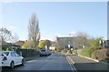
1
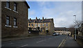
Castle Street
View along northern part of Castle Street.
Image: © habiloid
Taken: 2 Mar 2019
0.02 miles
2
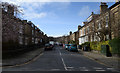
Hall Royd
View up Hall Royd from Castle Street.
Image: © habiloid
Taken: 2 Mar 2019
0.02 miles
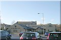
4
West Yorkshire Police Station - Manor Lane
Image: © Betty Longbottom
Taken: 12 Nov 2008
0.04 miles
5
Westcliffe Road - Manor Lane, Shipley
Image: © Betty Longbottom
Taken: 12 Nov 2008
0.04 miles
7
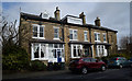
Hall Royd
Some houses at the eastern end of Hall Royd.
Image: © habiloid
Taken: 2 Mar 2019
0.05 miles
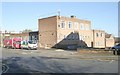
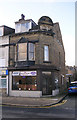
8
Westcliffe Medical Centre - Manor Lane, Shipley
Image: © Betty Longbottom
Taken: 12 Nov 2008
0.05 miles
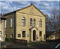
9
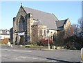
Northcliffe Church - Bradford Road
This is a joint Methodist & United Reformed Church - it was previously Hall Royd Methodist Church.
Image: © Betty Longbottom
Taken: 12 Nov 2008
0.05 miles
10
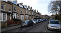
Houses on Westcliffe Road
Looking west along Westcliffe Road.
Image: © habiloid
Taken: 2 Mar 2019
0.05 miles