IMAGES TAKEN NEAR TO
Wrose Road, SHIPLEY, BD18 1HX
Introduction
This page details the photographs taken nearby to Wrose Road, BD18 1HX by members of the Geograph project.
The Geograph project started in 2005 with the aim of publishing, organising and preserving representative images for every square kilometre of Great Britain, Ireland and the Isle of Man.

There are currently over 7.5m images from over14,400 individuals and you can help contribute to the project by visiting https://www.geograph.org.uk
Image Map
Images are licensed for reuse under creativecommons.org/licenses/by-sa/2.0
Notes
- Clicking on the map will re-center to the selected point.
- The higher the marker number, the further away the image location is from the centre of the postcode.
Image Listing (95 Images Found)
Images are licensed for reuse under creativecommons.org/licenses/by-sa/2.0
Image
Details
Distance
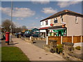
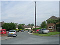
1
Wrose Community Centre - Wrose Road
Image: © Betty Longbottom
Taken: 27 Dec 2007
0.01 miles
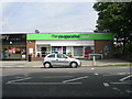
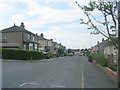
4
Shipley: Wrose Post Office
A sub post office on Wrose Road, high above the town centre to the south.
Image: © Chris Downer
Taken: 22 Apr 2010
0.03 miles
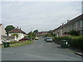
5
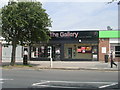
The Gallery Hair & Beauty - Wrose Road
Image: © Betty Longbottom
Taken: 5 Jul 2011
0.04 miles
6
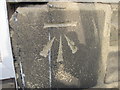
Ordnance Survey Cut Mark
This mark can be found on the wall of 111 Wrose Road.
For more details see : http://www.bench-marks.org.uk/bm41672
Image: © Peter Wood
Taken: 2 Mar 2012
0.04 miles
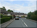
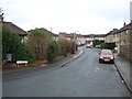
9
Thornacre Road - viewed from Thornacre Crescent
Image: © Betty Longbottom
Taken: 5 Jul 2011
0.05 miles