IMAGES TAKEN NEAR TO
Higher Coach Road, SHIPLEY, BD17 5SW
Introduction
This page details the photographs taken nearby to Higher Coach Road, BD17 5SW by members of the Geograph project.
The Geograph project started in 2005 with the aim of publishing, organising and preserving representative images for every square kilometre of Great Britain, Ireland and the Isle of Man.

There are currently over 7.5m images from over14,400 individuals and you can help contribute to the project by visiting https://www.geograph.org.uk
Image Map
Images are licensed for reuse under creativecommons.org/licenses/by-sa/2.0
Notes
- Clicking on the map will re-center to the selected point.
- The higher the marker number, the further away the image location is from the centre of the postcode.
Image Listing (210 Images Found)
Images are licensed for reuse under creativecommons.org/licenses/by-sa/2.0
Image
Details
Distance
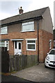
1
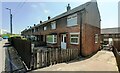
Houses on south side of Higher Coach Road: #112 nearest
Image: © Luke Shaw
Taken: 26 Jun 2024
0.01 miles
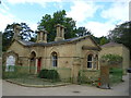
2
Benchmark on #112 Higher Coach Road
Ordnance Survey cut mark benchmark described on the Bench Mark Database at http://www.bench-marks.org.uk/bm69409
Image: © Roger Templeman
Taken: 27 Jul 2015
0.02 miles
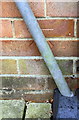
3
#112 Higher Coach Road
There is an OS benchmark Image on the front of the house, left of the black downpipe and hidden by the wooden fence
Image: © Roger Templeman
Taken: 27 Jul 2015
0.02 miles
4
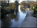
Saltaire
Looking west along the Leeds and Liverpool canal.
Image: © Jim Easterbrook
Taken: 29 Dec 2003
0.03 miles
5
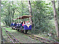
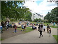
Shipley Glen Railway
The Shipley glen tramway runs through the popular visitor attraction of Shipley Glen, constructed in 1895 with two open carriages. The trams were rebuilt in 1928 during the conversion to electric power and again in 1955 and 1990. The tramway closed in 1966 after a small accident but was saved from closure in 1969. The tramway again closed in 1982 and it was extensively repaired.The Tramway is now run by volunteer Trustees and volunteers from the local public. SGT is owned by Bradford Council and the Tustees have taken a 125 year lease on a full repair and maintenance basis,
(Thanks to Glentramway for information)
Image: © Mick Melvin
Taken: 6 Jun 2004
0.03 miles
6
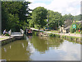
Hirst Mill Swing Bridge
Looking west to Hirst Mill Swing Bridge, on the Leeds and Liverpool Canal, near Saltaire, West Yorkshire.
Image: © Martin Clark
Taken: Unknown
0.03 miles
7
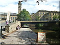
Saltaire: Canal bridge and Salts Mill
Image: © Dr Neil Clifton
Taken: 26 Aug 2016
0.03 miles