IMAGES TAKEN NEAR TO
Bowland Avenue, SHIPLEY, BD17 5SA
Introduction
This page details the photographs taken nearby to Bowland Avenue, BD17 5SA by members of the Geograph project.
The Geograph project started in 2005 with the aim of publishing, organising and preserving representative images for every square kilometre of Great Britain, Ireland and the Isle of Man.

There are currently over 7.5m images from over14,400 individuals and you can help contribute to the project by visiting https://www.geograph.org.uk
Image Map
Images are licensed for reuse under creativecommons.org/licenses/by-sa/2.0
Notes
- Clicking on the map will re-center to the selected point.
- The higher the marker number, the further away the image location is from the centre of the postcode.
Image Listing (188 Images Found)
Images are licensed for reuse under creativecommons.org/licenses/by-sa/2.0
Image
Details
Distance
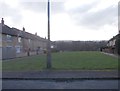
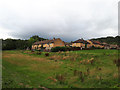
5
Footpaths and green space, Shipley Glen
Leading from the bus turning circle on Higher Coach Road to Glenwood Avenue.
Image: © Richard Vince
Taken: 16 Sep 2022
0.03 miles
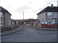
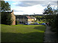
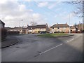
6
Bowland Avenue
Part of the Glenwood estate.
Image: © Stephen Craven
Taken: 19 Aug 2018
0.03 miles
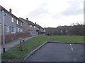
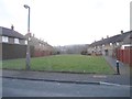
7
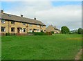
Glenwood Avenue
The houses are grouped with their fronts facing outwards to grassy areas, and access for cars is between the houses at the back.
Image: © Rich Tea
Taken: 28 May 2009
0.05 miles
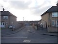
8
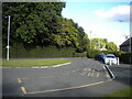
Bus turning circle, Shipley Glen
On Higher Coach Road.
Image: © Richard Vince
Taken: 16 Sep 2022
0.05 miles
10
Bus Turning Circle - Higher Coach Road
Image: © Betty Longbottom
Taken: 1 Feb 2012
0.06 miles