IMAGES TAKEN NEAR TO
Cooper Close, BINGLEY, BD16 4SD
Introduction
This page details the photographs taken nearby to Cooper Close, BD16 4SD by members of the Geograph project.
The Geograph project started in 2005 with the aim of publishing, organising and preserving representative images for every square kilometre of Great Britain, Ireland and the Isle of Man.

There are currently over 7.5m images from over14,400 individuals and you can help contribute to the project by visiting https://www.geograph.org.uk
Image Map (85 Images)


Getting Data...Please wait
Leaflet Map data © OpenStreetMap
Images are licensed for reuse under creativecommons.org/licenses/by-sa/2.0
Notes
- Clicking on the map will re-center to the selected point.
- The higher the marker number, the further away the image location is from the centre of the postcode.
Image Listing (85 Images Found)
Images are licensed for reuse under creativecommons.org/licenses/by-sa/2.0
Image
Details
Distance
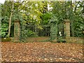
3
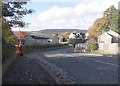
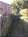
Entrance to private woodland, Lady Lane
There is an OS benchmark Image on the straight wall at its junction with the curved wall towards the gatepost.
Image: © Roger Templeman
Taken: 27 Jul 2012
0.05 miles
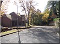
4
Former college entrance off Lady Lane
These were the gates to the West Riding Teacher Training College Image that closed in 1979. The main building still exists, converted to apartments, but now approached from the east.
Image: © Stephen Craven
Taken: 16 Nov 2021
0.05 miles
5
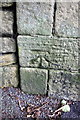
Benchmark on Lady Lane wall at entrance to woodland
Ordnance Survey cut mark benchmark described on the Bench Mark Database at http://www.bench-marks.org.uk/bm37516
Image: © Roger Templeman
Taken: 27 Jul 2012
0.06 miles
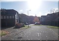
6
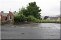
Junction of Lady Lane and Oakwood Drive
Image: © Roger Templeman
Taken: 9 Jul 2012
0.06 miles
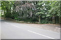
10
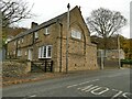
Old building, Lady Lane
This looks like a former school building but isn't labelled as such on any old maps I've looked at.
Image: © Stephen Craven
Taken: 16 Nov 2021
0.07 miles