IMAGES TAKEN NEAR TO
Belgrave Road, BINGLEY, BD16 4NG
Introduction
This page details the photographs taken nearby to Belgrave Road, BD16 4NG by members of the Geograph project.
The Geograph project started in 2005 with the aim of publishing, organising and preserving representative images for every square kilometre of Great Britain, Ireland and the Isle of Man.

There are currently over 7.5m images from over14,400 individuals and you can help contribute to the project by visiting https://www.geograph.org.uk
Image Map (Loading...)


Getting Data...Please wait
Leaflet Map data © OpenStreetMap
Images are licensed for reuse under creativecommons.org/licenses/by-sa/2.0
Notes
- Clicking on the map will re-center to the selected point.
- The higher the marker number, the further away the image location is from the centre of the postcode.
Image Listing (213 Images Found)
Images are licensed for reuse under creativecommons.org/licenses/by-sa/2.0
Image
Details
Distance
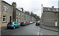
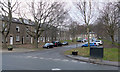
1
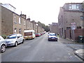
Belgrave Road - viewed from Norman Street
Image: © Betty Longbottom
Taken: 29 Sep 2012
0.02 miles
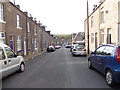
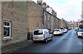
4
Belgrave Road - viewed from Norman Street
Image: © Betty Longbottom
Taken: 29 Sep 2012
0.03 miles
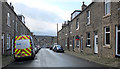
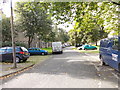
9
Marion Street, Bingley
Mornington Road runs across the foreground.
Image: © habiloid
Taken: 4 Jan 2020
0.05 miles
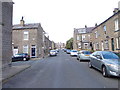
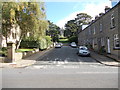
10
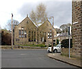
Old Board School building on Belgrave Road seen from Herbert Street, Bingley
Image: © habiloid
Taken: 10 Apr 2021
0.06 miles