IMAGES TAKEN NEAR TO
Granville Terrace, BINGLEY, BD16 4HW
Introduction
This page details the photographs taken nearby to Granville Terrace, BD16 4HW by members of the Geograph project.
The Geograph project started in 2005 with the aim of publishing, organising and preserving representative images for every square kilometre of Great Britain, Ireland and the Isle of Man.

There are currently over 7.5m images from over14,400 individuals and you can help contribute to the project by visiting https://www.geograph.org.uk
Image Map
Images are licensed for reuse under creativecommons.org/licenses/by-sa/2.0
Notes
- Clicking on the map will re-center to the selected point.
- The higher the marker number, the further away the image location is from the centre of the postcode.
Image Listing (141 Images Found)
Images are licensed for reuse under creativecommons.org/licenses/by-sa/2.0
Image
Details
Distance
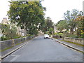
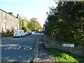
2
Granville Terrace - looking towards Crownest Lane
Image: © Betty Longbottom
Taken: 29 Sep 2012
0.02 miles
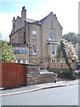
4
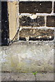
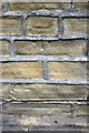
Benchmark on #1 Fernbank Drive
Ordnance Survey cut mark benchmark described on the Bench Mark Database at http://www.bench-marks.org.uk/bm69530
Image: © Roger Templeman
Taken: 8 Aug 2015
0.05 miles
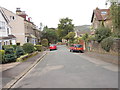
5
Pre-Worboys road direction sign, Fernbank Drive, Bingley
At the junction with Crow Nest Road (a right fork out of sight). This has probably survived because it is at the junction, not an advance warning sign, and so has presumably been classed as a finger-post.
Image: © Humphrey Bolton
Taken: 22 Oct 2011
0.05 miles
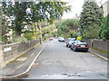
6
#1 Fernbank Drive
There is an OS benchmark Image on the front of the house, right of the coal hole door
Image: © Roger Templeman
Taken: 8 Aug 2015
0.05 miles
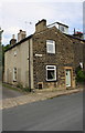
9

'Ivy House' at junction of Crowsnest Lane and Ellen Street
There is an OS benchmark Image on the wall fronting the house beneath the ivy to the left of the house's front door.
Image: © Roger Templeman
Taken: 8 Aug 2015
0.07 miles
10
Benchmark on wall fronting 'Ivy House'
Ordnance Survey cut mark benchmark described on the Bench Mark Database at http://www.bench-marks.org.uk/bm69529
Image: © Roger Templeman
Taken: 8 Aug 2015
0.07 miles