IMAGES TAKEN NEAR TO
Agincourt Drive, BINGLEY, BD16 3JY
Introduction
This page details the photographs taken nearby to Agincourt Drive, BD16 3JY by members of the Geograph project.
The Geograph project started in 2005 with the aim of publishing, organising and preserving representative images for every square kilometre of Great Britain, Ireland and the Isle of Man.

There are currently over 7.5m images from over14,400 individuals and you can help contribute to the project by visiting https://www.geograph.org.uk
Image Map
Images are licensed for reuse under creativecommons.org/licenses/by-sa/2.0
Notes
- Clicking on the map will re-center to the selected point.
- The higher the marker number, the further away the image location is from the centre of the postcode.
Image Listing (52 Images Found)
Images are licensed for reuse under creativecommons.org/licenses/by-sa/2.0
Image
Details
Distance
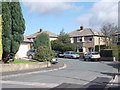
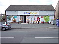
1
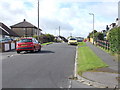
Clarendon Road - viewed from Heaton Drive
Image: © Betty Longbottom
Taken: 29 Sep 2012
0.05 miles
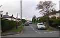
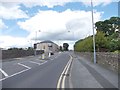
2
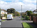
Clarendon Road - viewed from Heaton Drive
Image: © Betty Longbottom
Taken: 29 Sep 2012
0.06 miles
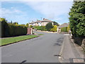
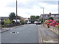
4
Agincourt Drive - Eldwick
These houses are built alongside the Old Water Works Site, which is also to be a housing development.
Image: © Betty Longbottom
Taken: 10 Oct 2007
0.07 miles
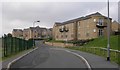
8
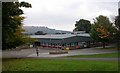
Eldwick Primary School - Warren Lane
Image: © Betty Longbottom
Taken: 10 Oct 2007
0.12 miles
10
Warren Lane - viewed from Swan Avenue
Image: © Betty Longbottom
Taken: 18 Jun 2012
0.13 miles