IMAGES TAKEN NEAR TO
North Bank Road, BINGLEY, BD16 1UH
Introduction
This page details the photographs taken nearby to North Bank Road, BD16 1UH by members of the Geograph project.
The Geograph project started in 2005 with the aim of publishing, organising and preserving representative images for every square kilometre of Great Britain, Ireland and the Isle of Man.

There are currently over 7.5m images from over14,400 individuals and you can help contribute to the project by visiting https://www.geograph.org.uk
Image Map (Loading...)


Getting Data...Please wait
Leaflet Map data © OpenStreetMap
Images are licensed for reuse under creativecommons.org/licenses/by-sa/2.0
Notes
- Clicking on the map will re-center to the selected point.
- The higher the marker number, the further away the image location is from the centre of the postcode.
Image Listing (27 Images Found)
Images are licensed for reuse under creativecommons.org/licenses/by-sa/2.0
Image
Details
Distance
1
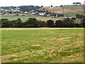
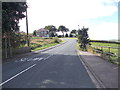
Cottingley Moor and North Bank Road
The trees mark the course of Cottingley Beck, and, beyond, North Bank Road climbs to Noon Nick at the opposite side of the gridsquare. North Bank Road is conjectured to be a continuation on a different alignment of the Lee Lane Roman road.
Image: © David Spencer
Taken: 16 Aug 2005
0.08 miles
2
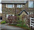
32 Stoney Ridge Road, Cottingley
According to the OS benchmark database there is a benchmark cut into the south-east facing wall of the property. Nothing could be seen from the roadside.
Image: © Mel Towler
Taken: 1 May 2023
0.10 miles
3
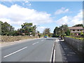
Stoney Ridge Road - viewed from near Woodland Crescent
Image: © Betty Longbottom
Taken: 4 Sep 2012
0.11 miles
4
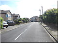
Woodland Crescent - Stoney Ridge Road
Image: © Betty Longbottom
Taken: 4 Sep 2012
0.12 miles
5
Stoney Ridge Avenue - viewed from near Woodland Crescent
Image: © Betty Longbottom
Taken: 4 Sep 2012
0.12 miles
6
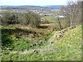
Gully at Noon Nick
The 1850 map shows coal pits down the hillside.
Image: © Humphrey Bolton
Taken: 15 Apr 2013
0.13 miles
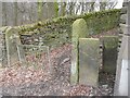
7
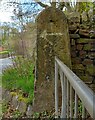
Benchmark cut into gatepost at start of track
The benchmark is cut into a stone gatepost at the start of a track on the south side of Stoney Ridge Road. Wider view Image]
Image: © Mel Towler
Taken: 1 May 2023
0.13 miles
8
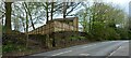
Start of public footpath on Stoney Ridge Road
There is a benchmark cut into the left stone gatepost at the start of the track on the south side of Stoney Ridge Road. Closer view Image]
Image: © Mel Towler
Taken: 1 May 2023
0.13 miles
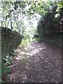
10
Footpath off Stoney Ridge Road
This looks like an old path, but as a right-of-way only goes to a modern housing estate. The OS map does, however, show a path through to Haworth Road via Brantwood Avenue. The path is not shown on the 1850 OS map.
Image: © Humphrey Bolton
Taken: 8 Apr 2013
0.13 miles