IMAGES TAKEN NEAR TO
The Willows, BINGLEY, BD16 1LL
Introduction
This page details the photographs taken nearby to The Willows, BD16 1LL by members of the Geograph project.
The Geograph project started in 2005 with the aim of publishing, organising and preserving representative images for every square kilometre of Great Britain, Ireland and the Isle of Man.

There are currently over 7.5m images from over14,400 individuals and you can help contribute to the project by visiting https://www.geograph.org.uk
Image Map (101 Images)


Getting Data...Please wait
Leaflet Map data © OpenStreetMap
Images are licensed for reuse under creativecommons.org/licenses/by-sa/2.0
Notes
- Clicking on the map will re-center to the selected point.
- The higher the marker number, the further away the image location is from the centre of the postcode.
Image Listing (101 Images Found)
Images are licensed for reuse under creativecommons.org/licenses/by-sa/2.0
Image
Details
Distance
3
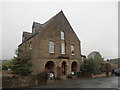
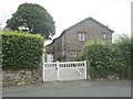
Former Wesleyan Chapel, Wilsden Old Road
Former chapel converted for residential use.
Image: © Stephen Armstrong
Taken: 17 Dec 2017
0.03 miles
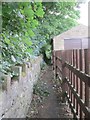
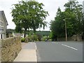
5
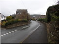
Wilsden Old Road, Harden
The tall building is the former Wesleyan Chapel. Image
Image: © Stephen Armstrong
Taken: 17 Dec 2017
0.05 miles
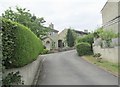
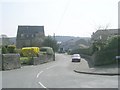
6
The Vicarage (St Saviour's) - Wilsden Old Road
Image: © Betty Longbottom
Taken: 20 Jul 2013
0.05 miles
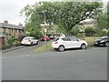
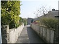
10
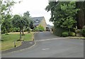
The Bull Field - off Wilsden Road
Image: © Betty Longbottom
Taken: 20 Jul 2013
0.09 miles