IMAGES TAKEN NEAR TO
Meadow Bank, BRADFORD, BD15 8HL
Introduction
This page details the photographs taken nearby to Meadow Bank, BD15 8HL by members of the Geograph project.
The Geograph project started in 2005 with the aim of publishing, organising and preserving representative images for every square kilometre of Great Britain, Ireland and the Isle of Man.

There are currently over 7.5m images from over14,400 individuals and you can help contribute to the project by visiting https://www.geograph.org.uk
Image Map
Images are licensed for reuse under creativecommons.org/licenses/by-sa/2.0
Notes
- Clicking on the map will re-center to the selected point.
- The higher the marker number, the further away the image location is from the centre of the postcode.
Image Listing (46 Images Found)
Images are licensed for reuse under creativecommons.org/licenses/by-sa/2.0
Image
Details
Distance
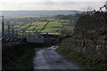
1

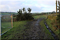
Muddy Track heading for West End Farm
Muddy track leading towards the farm buildings on Allerton Lane. All the pastures around here have been scrapped bare of grass with perimeters surrounded by temporary high fencing.
All the indications are this will soon be a huge building site.
Image: © Chris Heaton
Taken: 22 Dec 2016
0.05 miles
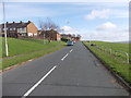
2
Muddy Track leading from West End Farm
Image: © Chris Heaton
Taken: 22 Dec 2016
0.08 miles
4
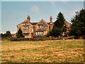
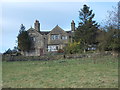
Dean House, Allerton
At the western side of the gridsquare, the Allerton housing estate gives way to open countryside at the bottom end of Bell Dean, with old houses. This one is Dean House, a Grade II* listed building built by Robert and Susan Dean in 1605.
Image: © David Spencer
Taken: 17 Aug 2005
0.11 miles
7
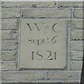
Datestone on Upper Bailey Fold Farm, Allerton
Unusual in having the month and day as well as the year. It is Grade II listed. See http://www.imagesofengland.org.uk/images/33/63/L336323 for an image of the building. The English Heritage listing states that the building material is sandstone 'bricks', which I take to mean that the blocks of stone are of similar size to bricks. The date is shown as the 8th in the listing details, but it is apparently not an easy matter to correct it.
Image: © Humphrey Bolton
Taken: 2 Mar 2010
0.12 miles
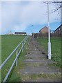
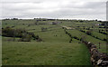
9
Descending Bailey Fold
Steep access lane leading down to Lower Bailey Fold Farm - with views over the valley of Pitty Beck and Thornton Village beyond, indicated by the church spire.
Image: © Chris Heaton
Taken: 22 Dec 2016
0.14 miles
10
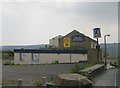
The Old Kings Head - Allerton Lane
Image: © Betty Longbottom
Taken: 26 Jun 2010
0.14 miles