Datestone on Upper Bailey Fold Farm, Allerton
Introduction
The photograph on this page of Datestone on Upper Bailey Fold Farm, Allerton by Humphrey Bolton as part of the Geograph project.
The Geograph project started in 2005 with the aim of publishing, organising and preserving representative images for every square kilometre of Great Britain, Ireland and the Isle of Man.

There are currently over 7.5m images from over 14,400 individuals and you can help contribute to the project by visiting https://www.geograph.org.uk
Datestone on Upper Bailey Fold Farm, Allerton
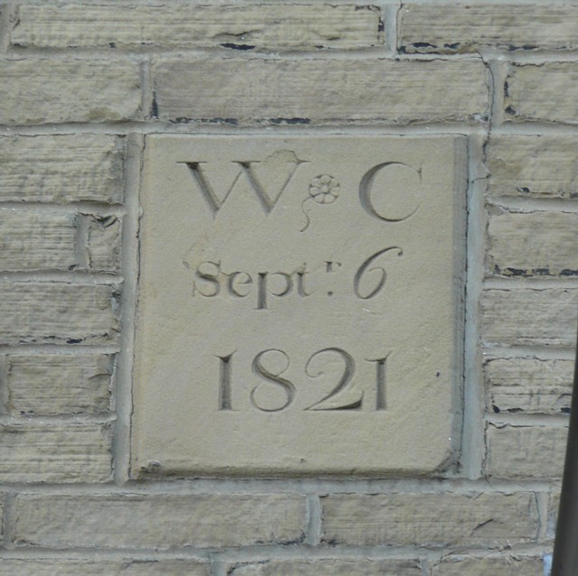
Image: © Humphrey Bolton Taken: 2 Mar 2010
Unusual in having the month and day as well as the year. It is Grade II listed. See http://www.imagesofengland.org.uk/images/33/63/L336323 for an image of the building. The English Heritage listing states that the building material is sandstone 'bricks', which I take to mean that the blocks of stone are of similar size to bricks. The date is shown as the 8th in the listing details, but it is apparently not an easy matter to correct it.
Images are licensed for reuse under creativecommons.org/licenses/by-sa/2.0
Image Location
Latitude
53.802186
Longitude
-1.834465