IMAGES TAKEN NEAR TO
Thornfield Terrace, BRADFORD, BD15 0NB
Introduction
This page details the photographs taken nearby to Thornfield Terrace, BD15 0NB by members of the Geograph project.
The Geograph project started in 2005 with the aim of publishing, organising and preserving representative images for every square kilometre of Great Britain, Ireland and the Isle of Man.

There are currently over 7.5m images from over14,400 individuals and you can help contribute to the project by visiting https://www.geograph.org.uk
Image Map
Images are licensed for reuse under creativecommons.org/licenses/by-sa/2.0
Notes
- Clicking on the map will re-center to the selected point.
- The higher the marker number, the further away the image location is from the centre of the postcode.
Image Listing (21 Images Found)
Images are licensed for reuse under creativecommons.org/licenses/by-sa/2.0
Image
Details
Distance
1
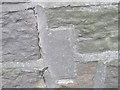
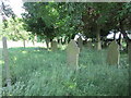
Ordnance Survey Flush Bracket S0898 (Remains)
The location of this now disappeared bracket can be found on the Old Sunday School (now a private dwelling) in Haworth Road.
For more detail see : http://www.geograph.org.uk/photo/2928768
Image: © Peter Wood
Taken: 4 May 2012
0.08 miles
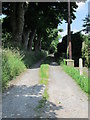
3
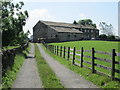
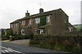
Track leading to Honey Pot Farm - Lane Side
Image: © Betty Longbottom
Taken: 6 Jul 2013
0.12 miles
6
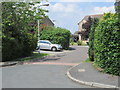
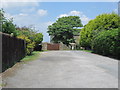
St Matthew's Close - Wellington Road
Image: © Betty Longbottom
Taken: 6 Jul 2013
0.17 miles
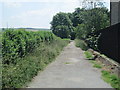
9
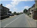
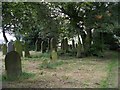
Lane Side - looking west from the junction with Crooke Lane
Image: © Betty Longbottom
Taken: 6 Jul 2013
0.20 miles