IMAGES TAKEN NEAR TO
Harrop Lane, BRADFORD, BD15 0BZ
Introduction
This page details the photographs taken nearby to Harrop Lane, BD15 0BZ by members of the Geograph project.
The Geograph project started in 2005 with the aim of publishing, organising and preserving representative images for every square kilometre of Great Britain, Ireland and the Isle of Man.

There are currently over 7.5m images from over14,400 individuals and you can help contribute to the project by visiting https://www.geograph.org.uk
Image Map
Images are licensed for reuse under creativecommons.org/licenses/by-sa/2.0
Notes
- Clicking on the map will re-center to the selected point.
- The higher the marker number, the further away the image location is from the centre of the postcode.
Image Listing (13 Images Found)
Images are licensed for reuse under creativecommons.org/licenses/by-sa/2.0
Image
Details
Distance
1
Harrop Lane
The van is parked at the entrance to the electricity station.
Image: © Christine Johnstone
Taken: 13 Jul 2011
0.08 miles
2
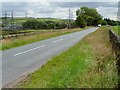
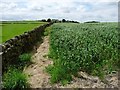
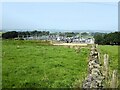
Gated footpath to New Holland
Both paths of Harrop Lane run parallel to dead straight field walls.
Image: © Christine Johnstone
Taken: 13 Jul 2011
0.09 miles
3
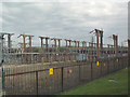
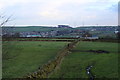
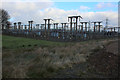
Bradford West National Grid substation
The pylons disfiguring the landscape for miles around in all directions march towards this huge switching station to the east of Harrop Lane serving the city of Bradford.
Image: © David Spencer
Taken: 16 Aug 2005
0.09 miles
4
Footpath signs on Harrop Lane, Pudding Hill
Instead of pointing across the lane, the signs point up and down it.
Image: © Christine Johnstone
Taken: 13 Jul 2011
0.10 miles
5
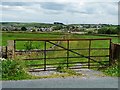
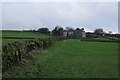
Footpath leading to New Holland Farm
Taken from Harrop Lane, the footpath follows the dry stone wall north east towards New Holland Farm, before hitting the B6144 at Wilsden
Image: © Chris Heaton
Taken: 22 Dec 2016
0.10 miles
6
Public footpath at field edge
The path links Harrop Lane and Old Allen Lane.
Image: © Christine Johnstone
Taken: 13 Jul 2011
0.12 miles
7
Footpath heading South West towards Old Allen Road
Image: © Chris Heaton
Taken: 22 Dec 2016
0.12 miles
8
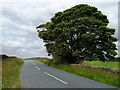
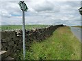
Tree alongside Harrop Lane
Just about marking the summit of Pudding Hill.
Image: © Christine Johnstone
Taken: 13 Jul 2011
0.14 miles
9
Bradford West Electricity Sub Station
This large sub station is the property of the National Grid, seen here by Harrop Lane.
The countryside, roundabout, is festooned with pylons that seem to march in several directions - all from this spot.
Image: © Chris Heaton
Taken: 22 Dec 2016
0.22 miles
10
Electricity Sub-station
Isolated in the middle of farmland, viewed from Old Allen Road.
Image: © Kevin Waterhouse
Taken: 6 Sep 2023
0.22 miles