IMAGES TAKEN NEAR TO
Mill Street, BRADFORD, BD13 5HA
Introduction
This page details the photographs taken nearby to Mill Street, BD13 5HA by members of the Geograph project.
The Geograph project started in 2005 with the aim of publishing, organising and preserving representative images for every square kilometre of Great Britain, Ireland and the Isle of Man.

There are currently over 7.5m images from over14,400 individuals and you can help contribute to the project by visiting https://www.geograph.org.uk
Image Map
Images are licensed for reuse under creativecommons.org/licenses/by-sa/2.0
Notes
- Clicking on the map will re-center to the selected point.
- The higher the marker number, the further away the image location is from the centre of the postcode.
Image Listing (137 Images Found)
Images are licensed for reuse under creativecommons.org/licenses/by-sa/2.0
Image
Details
Distance
1
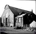
Cullingworth - Baptist Sunday School 1898
Image: © Alan Longbottom
Taken: Unknown
0.01 miles
2
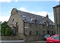
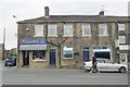
Baptist Sunday School - Croftside Court
Built 1898.
Image: © Betty Longbottom
Taken: 10 Jun 2008
0.02 miles
4
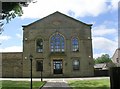
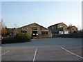
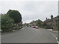
Cullingworth village hall
Situated across the road from the parish church. See also Image
Image: © Stephen Craven
Taken: 28 Oct 2017
0.03 miles
10
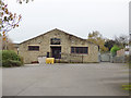
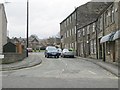
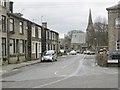
Station Road - viewed from the Church of St John the Evangelist
Image: © Betty Longbottom
Taken: 30 May 2014
0.04 miles