IMAGES TAKEN NEAR TO
BD13 5FN
Introduction
This page details the photographs taken nearby to BD13 5FN by members of the Geograph project.
The Geograph project started in 2005 with the aim of publishing, organising and preserving representative images for every square kilometre of Great Britain, Ireland and the Isle of Man.

There are currently over 7.5m images from over14,400 individuals and you can help contribute to the project by visiting https://www.geograph.org.uk
Image Map (Loading...)


Getting Data...Please wait
Leaflet Map data © OpenStreetMap
Images are licensed for reuse under creativecommons.org/licenses/by-sa/2.0
Notes
- Clicking on the map will re-center to the selected point.
- The higher the marker number, the further away the image location is from the centre of the postcode.
Image Listing (56 Images Found)
Images are licensed for reuse under creativecommons.org/licenses/by-sa/2.0
Image
Details
Distance
1
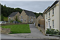
Newly-built housing in Castle Stead Drive, Cullingworth
Image: © David Martin
Taken: 15 Aug 2021
0.06 miles
2
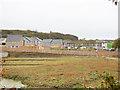
New housing south of Manywells Brow, Cullingworth
Seen from the former railway line, this will be a large housing estate when it is completed, and occupies the site of a former stone quarry.
Update April 2020: the field in the foreground is now being sold with planning permission for 25 houses (source: Telegraph and Argus).
Image: © Stephen Craven
Taken: 28 Oct 2017
0.10 miles
3
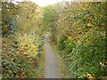
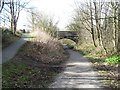
Great Northern Rail Trail approaching Cullingworth
Viewed from a footbridge Image
Image: © Stephen Craven
Taken: 28 Oct 2017
0.10 miles
7
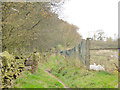
The Aire and Calder Link west of Cullingworth
Image: © Stephen Craven
Taken: 28 Oct 2017
0.12 miles
8
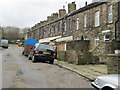
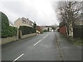
Clayton Terrace - Cullingworth Gate
Image: © Betty Longbottom
Taken: 3 Feb 2014
0.12 miles
9
Path junction at Cullingworth
The main path here is part of the Great Northern Trail and follows the old GNR rail track past Cullingworth. To the left is a ramp which joins a bridleway that passes over the bridge.
Image: © Gordon Hatton
Taken: 11 Feb 2016
0.12 miles
10
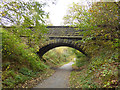
Footbridge over disused railway line
The footpath is the Aire and Calder Link; the railway route is now the Great Northern Rail Trail.
Image: © Stephen Craven
Taken: 28 Oct 2017
0.12 miles