IMAGES TAKEN NEAR TO
Long Causeway, BRADFORD, BD13 4ND
Introduction
This page details the photographs taken nearby to Long Causeway, BD13 4ND by members of the Geograph project.
The Geograph project started in 2005 with the aim of publishing, organising and preserving representative images for every square kilometre of Great Britain, Ireland and the Isle of Man.

There are currently over 7.5m images from over14,400 individuals and you can help contribute to the project by visiting https://www.geograph.org.uk
Image Map
Images are licensed for reuse under creativecommons.org/licenses/by-sa/2.0
Notes
- Clicking on the map will re-center to the selected point.
- The higher the marker number, the further away the image location is from the centre of the postcode.
Image Listing (26 Images Found)
Images are licensed for reuse under creativecommons.org/licenses/by-sa/2.0
Image
Details
Distance
1
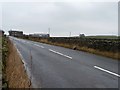
Long Causeway
Heading westwards, with Long Causewayside Farm on the horizon.
Image: © Christine Johnstone
Taken: 30 Jan 2014
0.06 miles
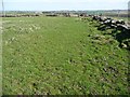
3
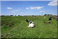
Cows in a field adjacent to Long Causeway
Image: © Jonathan Thacker
Taken: 19 May 2018
0.09 miles
4
Farmland on the south side of Long Causeway
West of Lower Shay Farm.
Image: © Christine Johnstone
Taken: 30 Jan 2014
0.11 miles
5
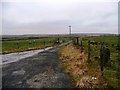
Farm track running south-west from Long Causeway
Also a public footpath and part of the Millennium Way.
Image: © Christine Johnstone
Taken: 30 Jan 2014
0.13 miles
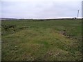
6
Footpath to Thornton Moor Reservoir
Image: © Alexander P Kapp
Taken: 30 Oct 2008
0.13 miles
7
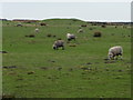
Sheep grazing on the north side of Long Causeway
East of Long Causewayside Farm.
Image: © Christine Johnstone
Taken: 30 Jan 2014
0.14 miles
8
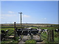
Gate on the Millennium Way
The wind farm on Hollin Hill in the distance.
Image: © Jonathan Thacker
Taken: 19 May 2018
0.14 miles
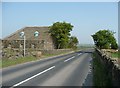
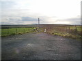
9
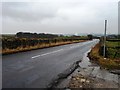
Long Causeway at the 338 metre spot height
Looking eastwards along the B6141.
Image: © Christine Johnstone
Taken: 30 Jan 2014
0.14 miles
10
Heading east to Denholme
Ridge-top public footpath.
Image: © Christine Johnstone
Taken: 18 Apr 2015
0.15 miles