IMAGES TAKEN NEAR TO
Water Meadow Drive, BRADFORD, BD13 4FA
Introduction
This page details the photographs taken nearby to Water Meadow Drive, BD13 4FA by members of the Geograph project.
The Geograph project started in 2005 with the aim of publishing, organising and preserving representative images for every square kilometre of Great Britain, Ireland and the Isle of Man.

There are currently over 7.5m images from over14,400 individuals and you can help contribute to the project by visiting https://www.geograph.org.uk
Image Map (68 Images)


Getting Data...Please wait
Leaflet Map data © OpenStreetMap
Images are licensed for reuse under creativecommons.org/licenses/by-sa/2.0
Notes
- Clicking on the map will re-center to the selected point.
- The higher the marker number, the further away the image location is from the centre of the postcode.
Image Listing (68 Images Found)
Images are licensed for reuse under creativecommons.org/licenses/by-sa/2.0
Image
Details
Distance
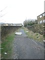
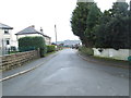
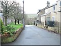
1
Old Road, Denholme
Old Road, leaves the Main Road A629 as a metalled thoroughfare before quickly becoming a narrow track. A new housing development is being undertaken above the new retaining wall on the right.
Image: © Chris Heaton
Taken: 13 Jul 2016
0.04 miles
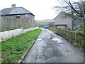
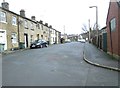
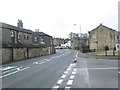
2
New Road - viewed from Seven Acres
Image: © Betty Longbottom
Taken: 18 Feb 2014
0.08 miles
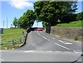
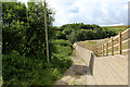
4
New Road - viewed from Seven Acres
Image: © Betty Longbottom
Taken: 18 Feb 2014
0.09 miles