IMAGES TAKEN NEAR TO
Gladstone Place, BRADFORD, BD13 4DW
Introduction
This page details the photographs taken nearby to Gladstone Place, BD13 4DW by members of the Geograph project.
The Geograph project started in 2005 with the aim of publishing, organising and preserving representative images for every square kilometre of Great Britain, Ireland and the Isle of Man.

There are currently over 7.5m images from over14,400 individuals and you can help contribute to the project by visiting https://www.geograph.org.uk
Image Map
Images are licensed for reuse under creativecommons.org/licenses/by-sa/2.0
Notes
- Clicking on the map will re-center to the selected point.
- The higher the marker number, the further away the image location is from the centre of the postcode.
Image Listing (47 Images Found)
Images are licensed for reuse under creativecommons.org/licenses/by-sa/2.0
Image
Details
Distance
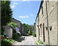
2
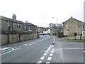
New Road - viewed from Seven Acres
Image: © Betty Longbottom
Taken: 18 Feb 2014
0.05 miles
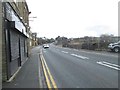
3
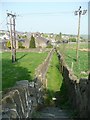
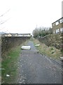
Footpath off Long Causeway, Denholme
Leading to New Road via Mount Pleasant.
Image: © Humphrey Bolton
Taken: 21 Apr 2011
0.06 miles
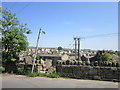
4
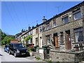
Houses old and new, Denholme
Seen from Long Causeway.
Image: © Humphrey Bolton
Taken: 21 Apr 2011
0.06 miles
7
New Road - viewed from Seven Acres
Image: © Betty Longbottom
Taken: 18 Feb 2014
0.06 miles
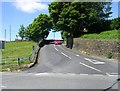
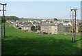
10
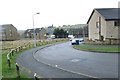
Seven Acres - looking towards New Road
Image: © Betty Longbottom
Taken: 18 Feb 2014
0.09 miles