IMAGES TAKEN NEAR TO
Roper Lane, BRADFORD, BD13 2NT
Introduction
This page details the photographs taken nearby to Roper Lane, BD13 2NT by members of the Geograph project.
The Geograph project started in 2005 with the aim of publishing, organising and preserving representative images for every square kilometre of Great Britain, Ireland and the Isle of Man.

There are currently over 7.5m images from over14,400 individuals and you can help contribute to the project by visiting https://www.geograph.org.uk
Image Map (Loading...)


Getting Data...Please wait
Leaflet Map data © OpenStreetMap
Images are licensed for reuse under creativecommons.org/licenses/by-sa/2.0
Notes
- Clicking on the map will re-center to the selected point.
- The higher the marker number, the further away the image location is from the centre of the postcode.
Image Listing (12 Images Found)
Images are licensed for reuse under creativecommons.org/licenses/by-sa/2.0
Image
Details
Distance
1
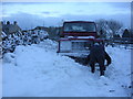
Digging out!
Old Guy Road closed due to snow.
Image: © Barbara Feather
Taken: 2 Mar 2005
0.18 miles
2
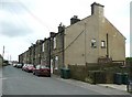
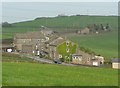
Mill Lane, Mountain, Queensbury
Not quite on top of a mountain, but these back-to-back houses, built no doubt for the workers at Mountain Mills, are at an altitude of 370m. There can't be many such houses as high as this in England. The mills were at over 365m and the site has been redeveloped as a housing estate.
Image: © Humphrey Bolton
Taken: 24 Jun 2010
0.18 miles
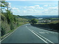
4
Old Guy Road - viewed from Mill Lane
Image: © Betty Longbottom
Taken: 19 Jun 2013
0.19 miles
5
Former White Castle Brewery Bradshaw Lane Queensbury
'White Castle Brewery' is the caption on my old six-inch map for this group of buildings.
Image: © Humphrey Bolton
Taken: 9 May 2008
0.20 miles
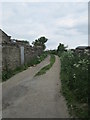
7
Grouse Moor Lane - looking towards Micklemoss Drive
Image: © Betty Longbottom
Taken: 19 Jun 2013
0.21 miles
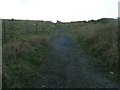
9
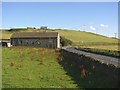
Building, Roper Lane, Queensbury
The building is unusual. It looks to have contained a two-storey cottage towards the road, and then there are four larger windows at an 'in-between' level. The name on the 1852 6” map is “Hop Houses”.
Image: © Humphrey Bolton
Taken: 12 Aug 2007
0.23 miles
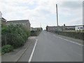
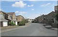
10

Old Guy Road heading North
Quiet road outside Queensbury Cricket Club heading towards Mountain
Image: © Chris Heaton
Taken: 21 Mar 2017
0.23 miles